MyTopo
Lacour Louisiana US Topo Map
Couldn't load pickup availability
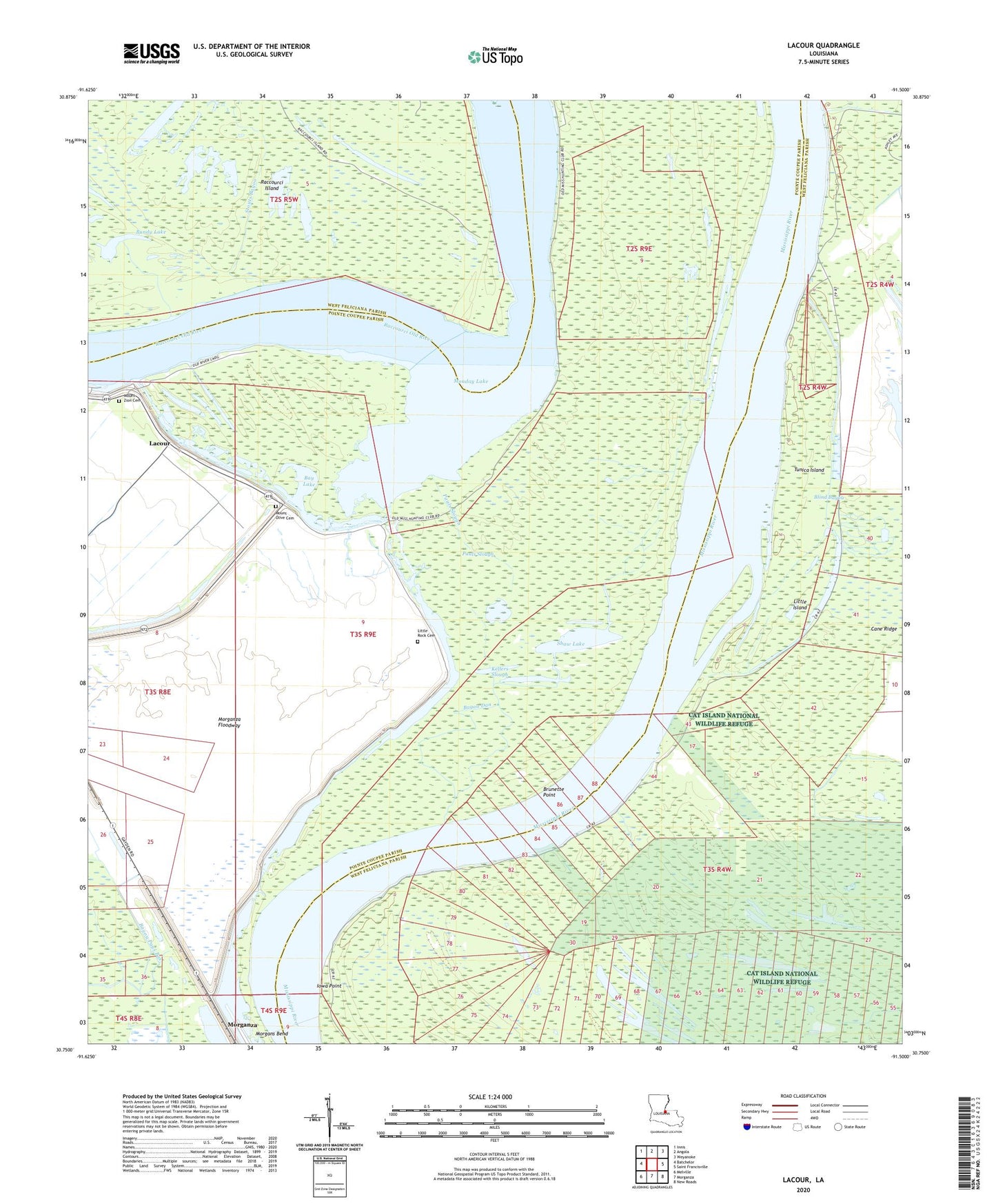
2024 topographic map quadrangle Lacour in the state of Louisiana. Scale: 1:24000. Based on the newly updated USGS 7.5' US Topo map series, this map is in the following counties: Pointe Coupee, West Feliciana. The map contains contour data, water features, and other items you are used to seeing on USGS maps, but also has updated roads and other features. This is the next generation of topographic maps. Printed on high-quality waterproof paper with UV fade-resistant inks.
Quads adjacent to this one:
West: Batchelor
Northwest: Innis
North: Angola
Northeast: Weyanoke
East: Saint Francisville
Southeast: New Roads
South: Morganza
Southwest: Melville
This map covers the same area as the classic USGS quad with code o30091g5.
Contains the following named places: Bay Lake, Bayou Dam Landing, Bayou Dan, Blind Bayou, Blue Bayou, Brownville, Brunette Point, Brunette Point Revetment, Bundy Lake, Cane Ridge, Cat Island National Wildlife Refuge, Catfish Landing, Cowhead Bayou, Greenwood Bend Revetment, Greenwood Landing, Iowa Point, Iowa Point Landing, Iowa Point Revetment, Jerusalem School, Kellers Slough, Killarny Farm Airport, Lacour, Lacour Plantation, Little Island, Little Rock Cemetery, Little Rock Church, Little Rock School, Monday Lake, Morganza Spillway, Mount Olive Cemetery, Mount Olive Church, Mount Zion Cemetery, Mount Zion Church, New Jerusalem Church, New Texas Landing, Pauls Slough, Pays Bayou, Raccourci, Ryans Landing, Saint Francisville Gas Field, Sebastopol Landing, Shaw Lake, Star Light Church, Stouts Bayou, Tunica Island