MyTopo
Fordoche Louisiana US Topo Map
Couldn't load pickup availability
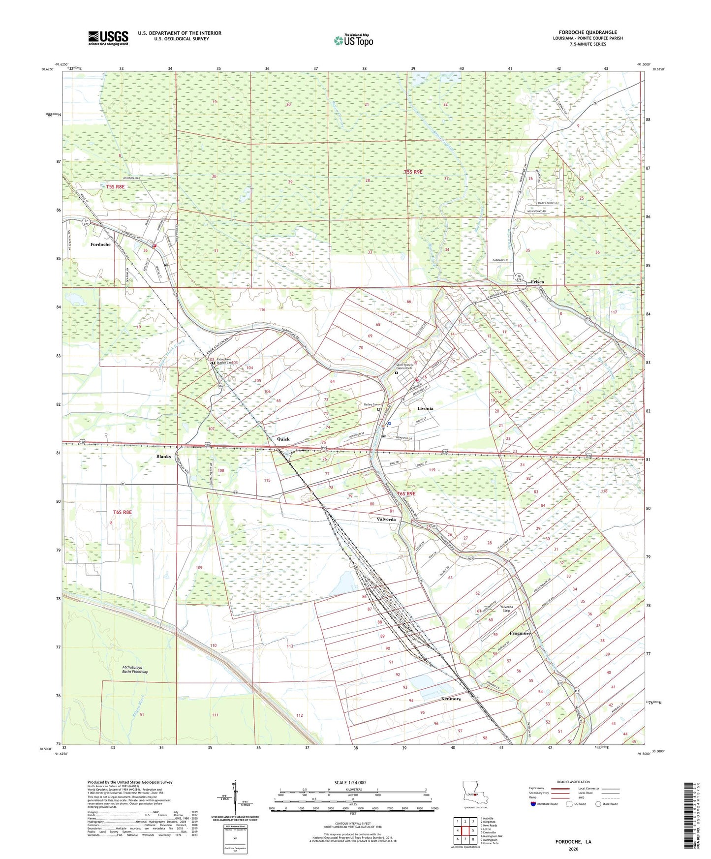
2024 topographic map quadrangle Fordoche in the state of Louisiana. Scale: 1:24000. Based on the newly updated USGS 7.5' US Topo map series, this map is in the following counties: Pointe Coupee. The map contains contour data, water features, and other items you are used to seeing on USGS maps, but also has updated roads and other features. This is the next generation of topographic maps. Printed on high-quality waterproof paper with UV fade-resistant inks.
Quads adjacent to this one:
West: Lottie
Northwest: Melville
North: Morganza
Northeast: New Roads
East: Erwinville
Southeast: Grosse Tete
South: Maringouin
Southwest: Maringouin NW
This map covers the same area as the classic USGS quad with code o30091e5.
Contains the following named places: Bailey Cemetery, Bayou Black, Bayou Blue, Bayou Cascare, Bayou Fordoche, Bayou Fordoche Oil Field, Bayou George, Bayou Portage, Blanks, Blanks Post Office, Faith Baptist Church of Livonia, False River, False River Station Cemetery, Fordoche, Fordoche Baptist Church, Fordoche Oil and Gas Field, Fordoche Police Department, Fordoche Post Office, Frisco, Frisco Oil Field, Frogmore, Iris Spur, Kenmore, Kingdom Hall of Jehovahs Witnesses, Little Zion Church, Livonia, Livonia High School, Livonia Oil Field, Livonia Police Department, Livonia Post Office, Mount Pilgrim Church, Pointe Coupee Fire District 4, Pointe Coupee Parish Library Livonia Branch, Pointe Coupee Parish Sheriff's Office, Quick, Rainbow Head Start Center School, Saint Caprina Church, Saint Francis of Cabrini Catholic Church, Saint Matthews Church, Sunlight Church, Town of Fordoche, Town of Livonia, Valverda, Valverda Elementary School, Valverda Strip, Ward Ten, ZIP Codes: 70732, 70755, 70756