MyTopo
Melville Louisiana US Topo Map
Couldn't load pickup availability
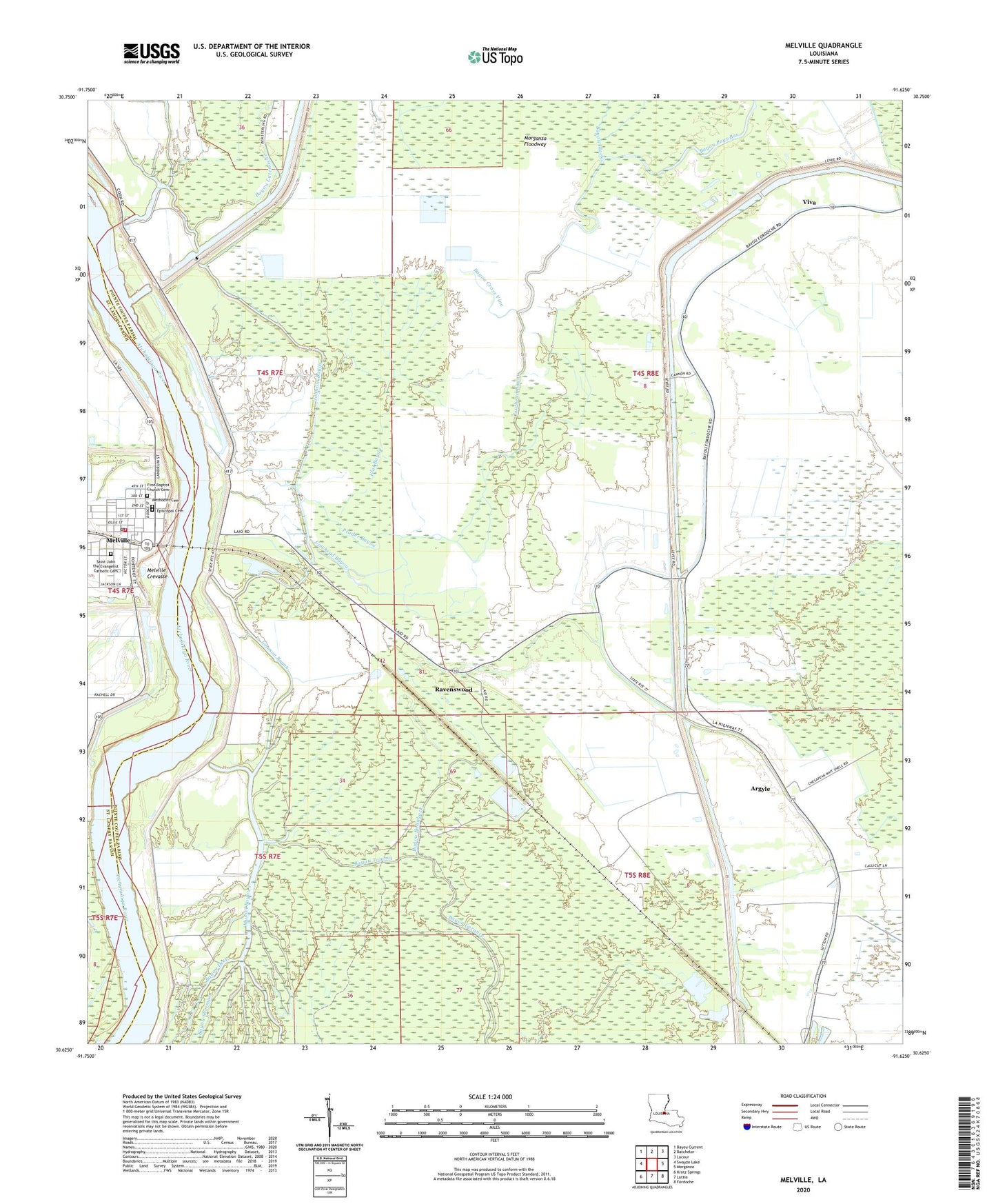
2024 topographic map quadrangle Melville in the state of Louisiana. Scale: 1:24000. Based on the newly updated USGS 7.5' US Topo map series, this map is in the following counties: Pointe Coupee, St. Landry. The map contains contour data, water features, and other items you are used to seeing on USGS maps, but also has updated roads and other features. This is the next generation of topographic maps. Printed on high-quality waterproof paper with UV fade-resistant inks.
Quads adjacent to this one:
West: Swayze Lake
Northwest: Bayou Current
North: Batchelor
Northeast: Lacour
East: Morganza
Southeast: Fordoche
South: Lottie
Southwest: Krotz Springs
This map covers the same area as the classic USGS quad with code o30091f6.
Contains the following named places: Argyle, Argyle Plantation, Bayou Ballahack, Bayou Big Sandy, Bayou Black, Bayou Cross Vine, Bayou Deep, Bayou Latenache, Bayou Latenache Drainage Canal, Bayou Little Sandy, Bayou Pays Bas, Bayou Sherman, Bayou Tommy, Bayou White Vine, Cowhead Bayou, Cross Bayou, Emma Zion Baptist Church, First Baptist Church, First Pentecostal Church, Flat Bayou, Johnson Bayou, Kingdom Hall of Jehovahs Witnesses, Melville, Melville Crevasse, Melville Elementary School, Melville Head Start Center School, Melville Police Department, Melville Volunteer Fire Department, Melville Wastewater Treatment Facility, Morganza Floodway, Morganza Gas Field, Morris Bayou, Mount Olive Church, Mussel Bayou, Pointe Coupee Drainage Structure, Prader Bayou, Ravenswood, Ravenswood Oil Field, Red Cross, Saint Landry Parish Police Jury, Town of Melville, Viva, Zion Traveler Church