MyTopo
Morrow Louisiana US Topo Map
Couldn't load pickup availability
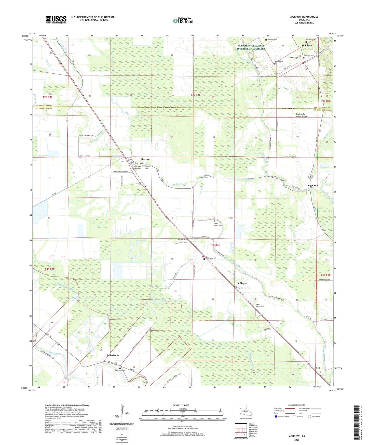
2020 topographic map quadrangle Morrow in the state of Louisiana. Scale: 1:24000. Based on the newly updated USGS 7.5' US Topo map series, this map is in the following counties: St. Landry, Avoyelles. The map contains contour data, water features, and other items you are used to seeing on USGS maps, but also has updated roads and other features. This is the next generation of topographic maps. Printed on high-quality waterproof paper with UV fade-resistant inks.
Quads adjacent to this one:
West: Whiteville
Northwest: Bunkie
North: Cottonport
Northeast: Plaucheville
East: Bayou Jack
Southeast: Palmetto
South: Beggs
Southwest: Tate Cove
Contains the following named places: Antioch Church, Big Cane, Big Cane Church, Big Cane Gas Field, Boretta, Burn School, Dry Bayou, Dubuisson, Goudeau, Goudeau Cemetery, Goudeau School, Goudeau Volunteer Fire Department, Gum Ridge, Hebert Cemetery, Le Moyen, Le Moyen Post Office, Lincoln School, Little Rock Church, Macedonia Church, Morrow, Morrow Cemetery, Morrow Census Designated Place, Morrow Elementary School, Morrow Post Office, Morrow Strip, Prairie Du Bayou Rouge, Richards Spur, Robinson Cemetery, Rosa, Rosa Post Office, Rosa School, Saint Catherines Church, Saint James Cemetery, Saint James Church, Saint Josephs Church, Saint Landry Parish Fire District 7 Morrow Volunteer Fire Station, Saint Luke Church, Saint Lukes Cemetery, Saint Marks Cemetery, Saint Marks Church, Saint Peters Catholic Church, Snowden Cemetery, State Canal, Zion Traveler Church, ZIP Code: 71356