MyTopo
Palmetto Louisiana US Topo Map
Couldn't load pickup availability
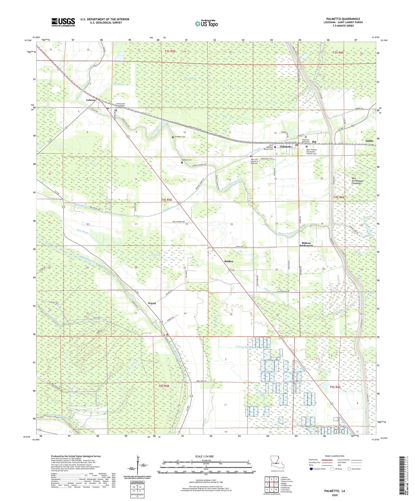
2024 topographic map quadrangle Palmetto in the state of Louisiana. Scale: 1:24000. Based on the newly updated USGS 7.5' US Topo map series, this map is in the following counties: St. Landry. The map contains contour data, water features, and other items you are used to seeing on USGS maps, but also has updated roads and other features. This is the next generation of topographic maps. Printed on high-quality waterproof paper with UV fade-resistant inks.
Quads adjacent to this one:
West: Beggs
Northwest: Morrow
North: Bayou Jack
Northeast: Bayou Current
East: Swayze Lake
Southeast: Krotz Springs
South: Port Barre
Southwest: Opelousas
This map covers the same area as the classic USGS quad with code o30091f8.
Contains the following named places: Bat, Bolden, Danks, Dick Bayou, East Prong Bayou, Goudeau Cemetery, Immaculata, Immaculate Conception Church, Immaculate Conception School, Lebeau, Lebeau Post Office, Little Wauksha Bayou, McBride Cemetery, New Jerusalem Church, New Pilgrim Baptist Church, North Central High School, Palmetto, Palmetto Elementary School, Palmetto Gas Field, Palmetto Post Office, Palmetto School, Palmetto Volunteer Fire Department, Parish Governing Authority District 5, Rideau Settlement, Sacred Heart Church, Saint James Church, Saint John Church, Saint Landry Parish Fire District 2 Waxia Substation, Saint Matthews Baptist Church, Saint Pauls Church, Sanctified Church, Thistlethwaite State Wildlife Management Area, Tri Community Nursing Center, Village of Palmetto, Ward Four, Waxia, ZIP Code: 71345