MyTopo
Napoleonville SW Louisiana US Topo Map
Couldn't load pickup availability
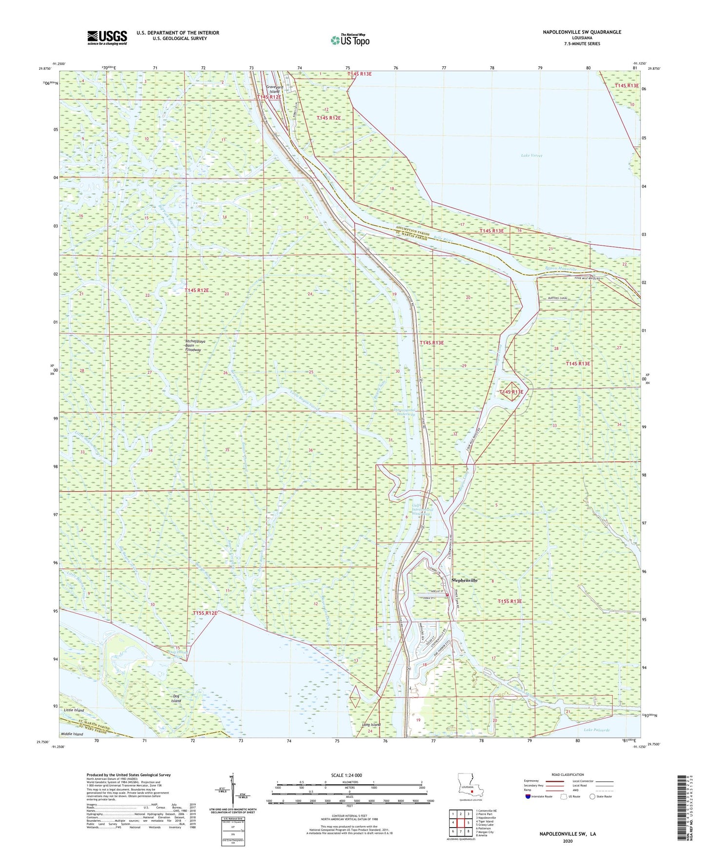
2024 topographic map quadrangle Napoleonville SW in the state of Louisiana. Scale: 1:24000. Based on the newly updated USGS 7.5' US Topo map series, this map is in the following counties: St. Martin, Assumption, St. Mary. The map contains contour data, water features, and other items you are used to seeing on USGS maps, but also has updated roads and other features. This is the next generation of topographic maps. Printed on high-quality waterproof paper with UV fade-resistant inks.
Quads adjacent to this one:
West: Tiger Island
Northwest: Centerville NE
North: Pierre Part
Northeast: Napoleonville
East: Grassy Lake
Southeast: Amelia
South: Morgan City
Southwest: Patterson
This map covers the same area as the classic USGS quad with code o29091g2.
Contains the following named places: Bayou Cane, Bayou Chevreuil, Bayou Cocodrie, Bayou Grosbeak, Bayou Gunnie, Bayou June, Bayou Long, Bayou Milhomme, Bayou Sam, Bear Bayou, Belle River, Big Bayou Jessie, Big Fork Bayou, Dog Island, Dog Island Pass, Flat Lake, Graveyard Island, Hog Bayou, Holy Cross Church, KFXY-FM (Morgan City), KMRC-AM (Morgan City), KVPO-FM (Berwick), Little Bayou Jessie, Little Bayou Sorrel, Stephensville Elementary School, Stephensville Gas Field, Stephensville Volunteer Fire Department, Stephensville Wastewater Treatment Plant, Stephenville, West Lake Verret Oil and Gas Field