MyTopo
Pierre Part Louisiana US Topo Map
Couldn't load pickup availability
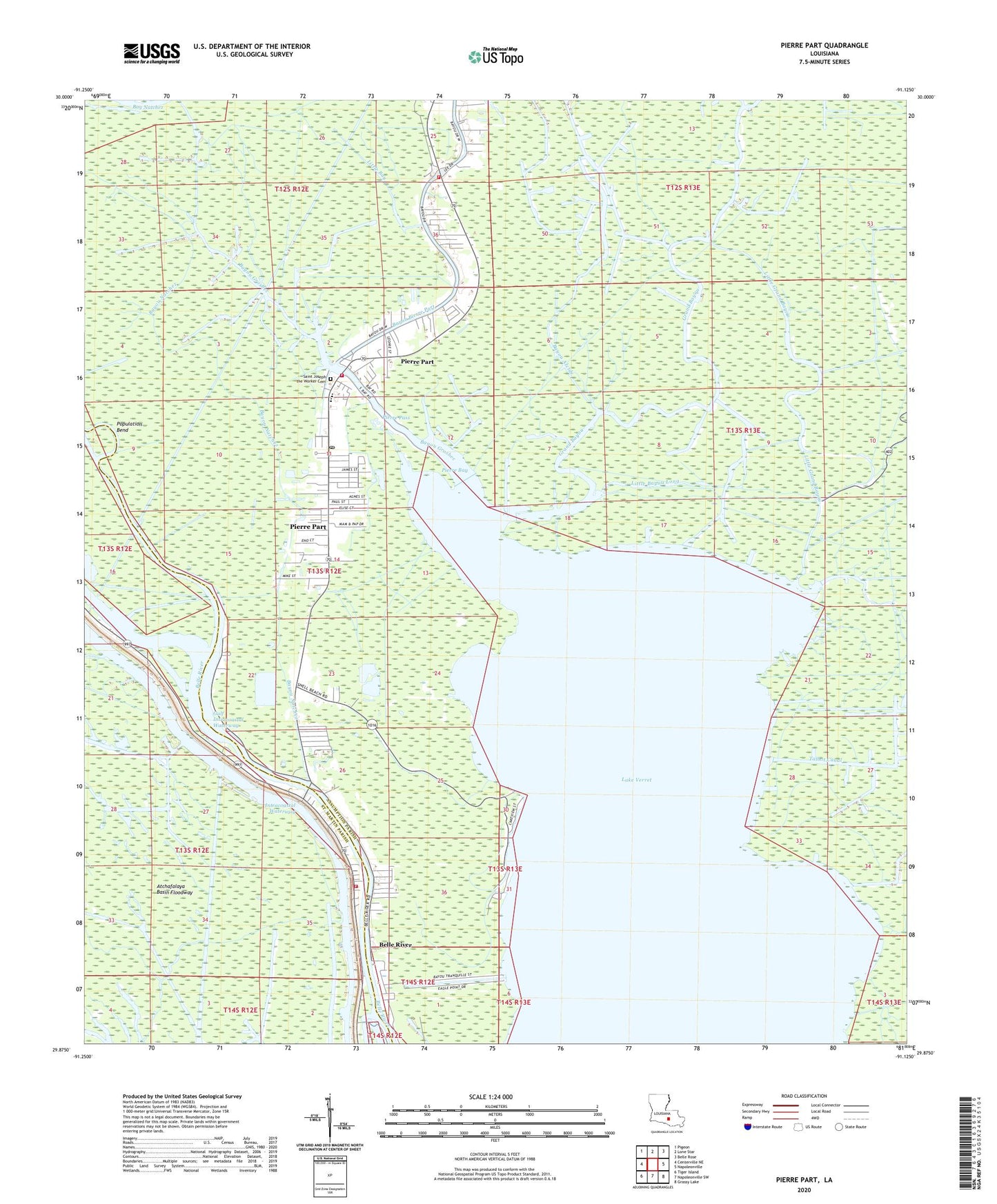
2024 topographic map quadrangle Pierre Part in the state of Louisiana. Scale: 1:24000. Based on the newly updated USGS 7.5' US Topo map series, this map is in the following counties: Assumption, St. Martin. The map contains contour data, water features, and other items you are used to seeing on USGS maps, but also has updated roads and other features. This is the next generation of topographic maps. Printed on high-quality waterproof paper with UV fade-resistant inks.
Quads adjacent to this one:
West: Centerville NE
Northwest: Pigeon
North: Lone Star
Northeast: Belle Rose
East: Napoleonville
Southeast: Grassy Lake
South: Napoleonville SW
Southwest: Tiger Island
This map covers the same area as the classic USGS quad with code o29091h2.
Contains the following named places: Assumption Parish Library Pierre Part Branch, Bayou Alcide, Bayou Grosbec, Bayou Natchez, Bayou Pierre Part, Bayou Saint Vincent Gas Field, Belle River, Belle River Church, Belle River Volunteer Fire Department, Grand Bayou, Graveyard Island Oil Field, Grosbec Bayou Gas Field, Ike Canal, Lake Verret, Little Bay, Little Bayou Long, Little Grand Bayou, Old River, Parish Governing Authority District 8, Parish Governing Authority District 9, Pierre Bay, Pierre Part, Pierre Part Census Designated Place, Pierre Part Christian Center, Pierre Part Elementary School, Pierre Part Middle School, Pierre Part Post Office, Pierre Part Volunteer Fire and Rescue Station 1, Pierre Part Volunteer Fire Department, Pierre Pass, Pierre Pass Gas Field, Population Bend, Sacred Heart Church, Saint Joseph the Worker Church, SaintLouis Canal, Talbot Canal, Victory Baptist Church, Ward Nine, ZIP Code: 70339