MyTopo
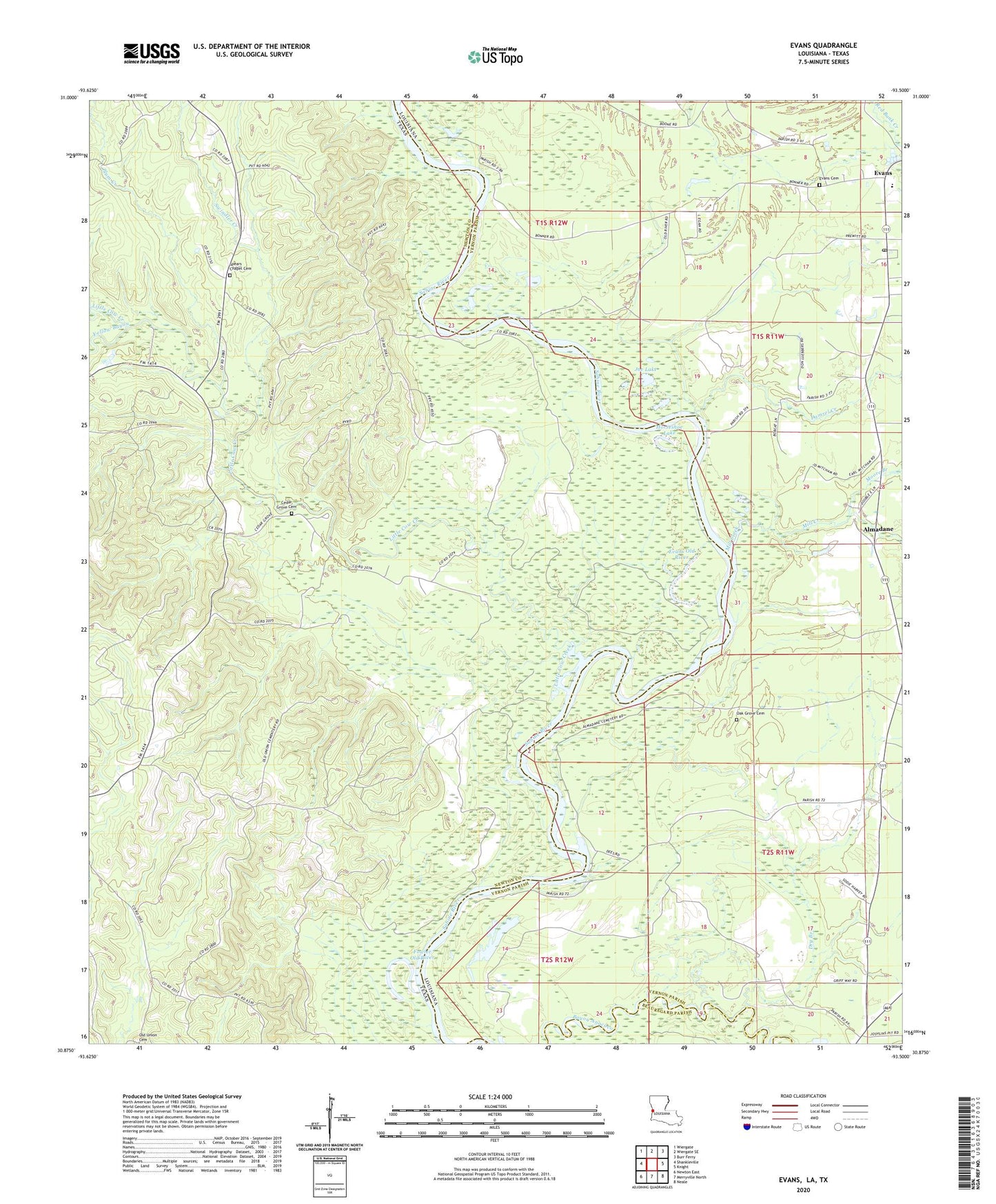
Evans Louisiana US Topo Map
Couldn't load pickup availability
2024 topographic map quadrangle Evans in the states of Texas, Louisiana. Scale: 1:24000. Based on the newly updated USGS 7.5' US Topo map series, this map is in the following counties: Vernon, Newton, Beauregard. The map contains contour data, water features, and other items you are used to seeing on USGS maps, but also has updated roads and other features. This is the next generation of topographic maps. Printed on high-quality waterproof paper with UV fade-resistant inks.
Quads adjacent to this one:
West: Shankleville
Northwest: Wiergate
North: Wiergate SE
Northeast: Burr Ferry
East: Knight
Southeast: Neale
South: Merryville North
Southwest: Newton East
Contains the following named places: Almadane, Almadane Cemetery, Cedar Grove Church, Damrel Creek, Dry Branch, Evans, Evans Cemetery, Evans High School, Evans Old River, Evans Post Office, Fowler Old River, Horseshoe Lake, Joe Lake, Little Cow Creek, Mill Creek, Moore Branch, Mount Olive Church, Plum Creek, Spears Chapel, Sutton Junction, Swindler Creek, Yellow Bayou