MyTopo
Peason Louisiana US Topo Map
Couldn't load pickup availability
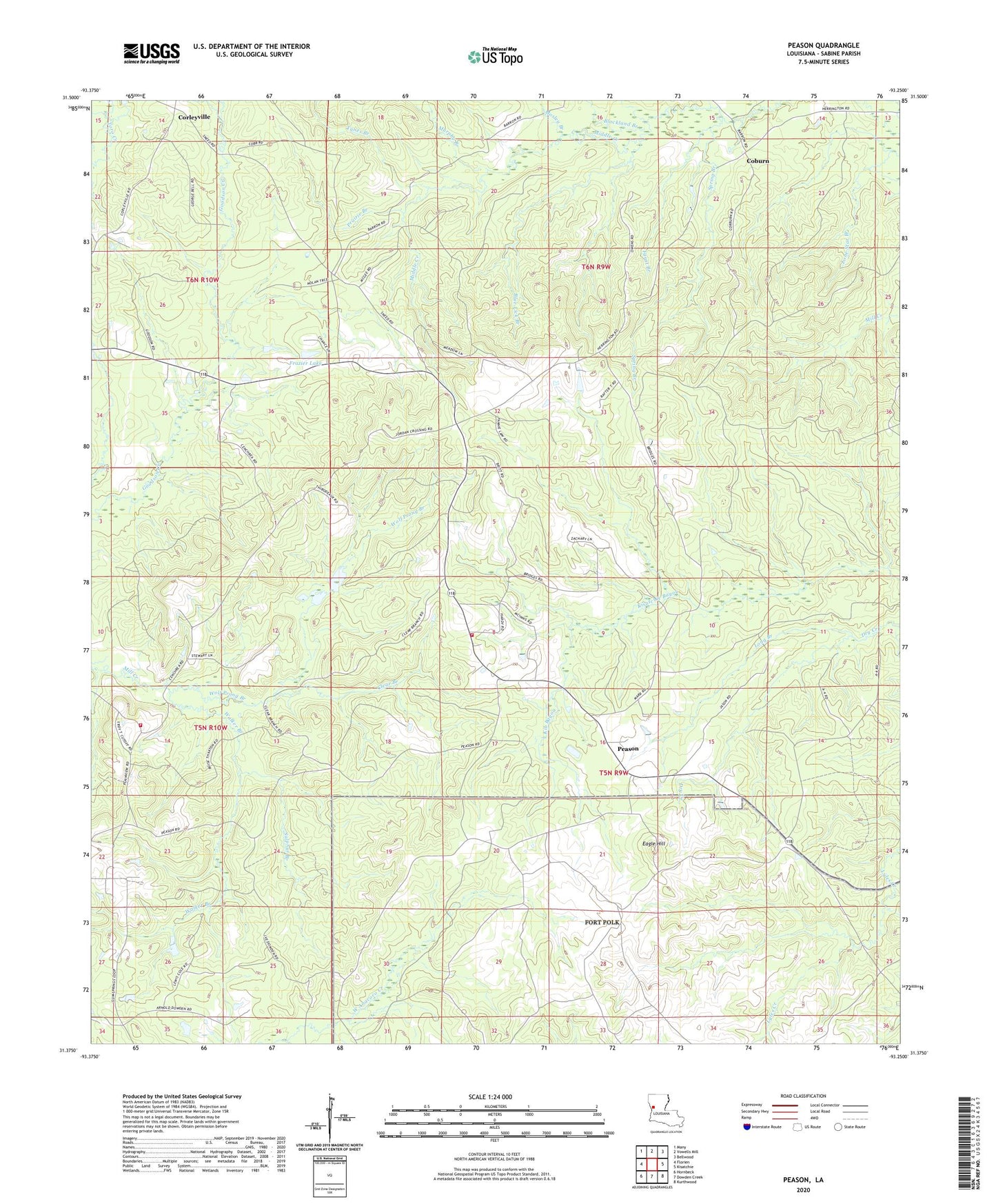
2024 topographic map quadrangle Peason in the state of Louisiana. Scale: 1:24000. Based on the newly updated USGS 7.5' US Topo map series, this map is in the following counties: Sabine. The map contains contour data, water features, and other items you are used to seeing on USGS maps, but also has updated roads and other features. This is the next generation of topographic maps. Printed on high-quality waterproof paper with UV fade-resistant inks.
Quads adjacent to this one:
West: Florien
Northwest: Many
North: Vowells Mill
Northeast: Bellwood
East: Kisatchie
Southeast: Kurthwood
South: Dowden Creek
Southwest: Hornbeck
This map covers the same area as the classic USGS quad with code o31093d3.
Contains the following named places: Blackland Branch, Blue Lick Branch, Century Church, Clear Branch, Coburn, Corleyville, Eagle Hill, Faust Branch, Frazier Lake, Gem Springs School, Kib Bayou, Lone Star Branch, Long Branch, Mosley Branch, Murphy Branch, Pearson Fire Department, Peason, Peason Church, Peason Lookout Tower, Peason Ridge State Wildlife Management Area, Plainview Fire Department, Prairie Branch, Spring Branch, Sulphur Branch, Tynes Branch, United Pentecostal Church, Walker Branch, Wolf Prong Branch