MyTopo
Vowells Mill Louisiana US Topo Map
Couldn't load pickup availability
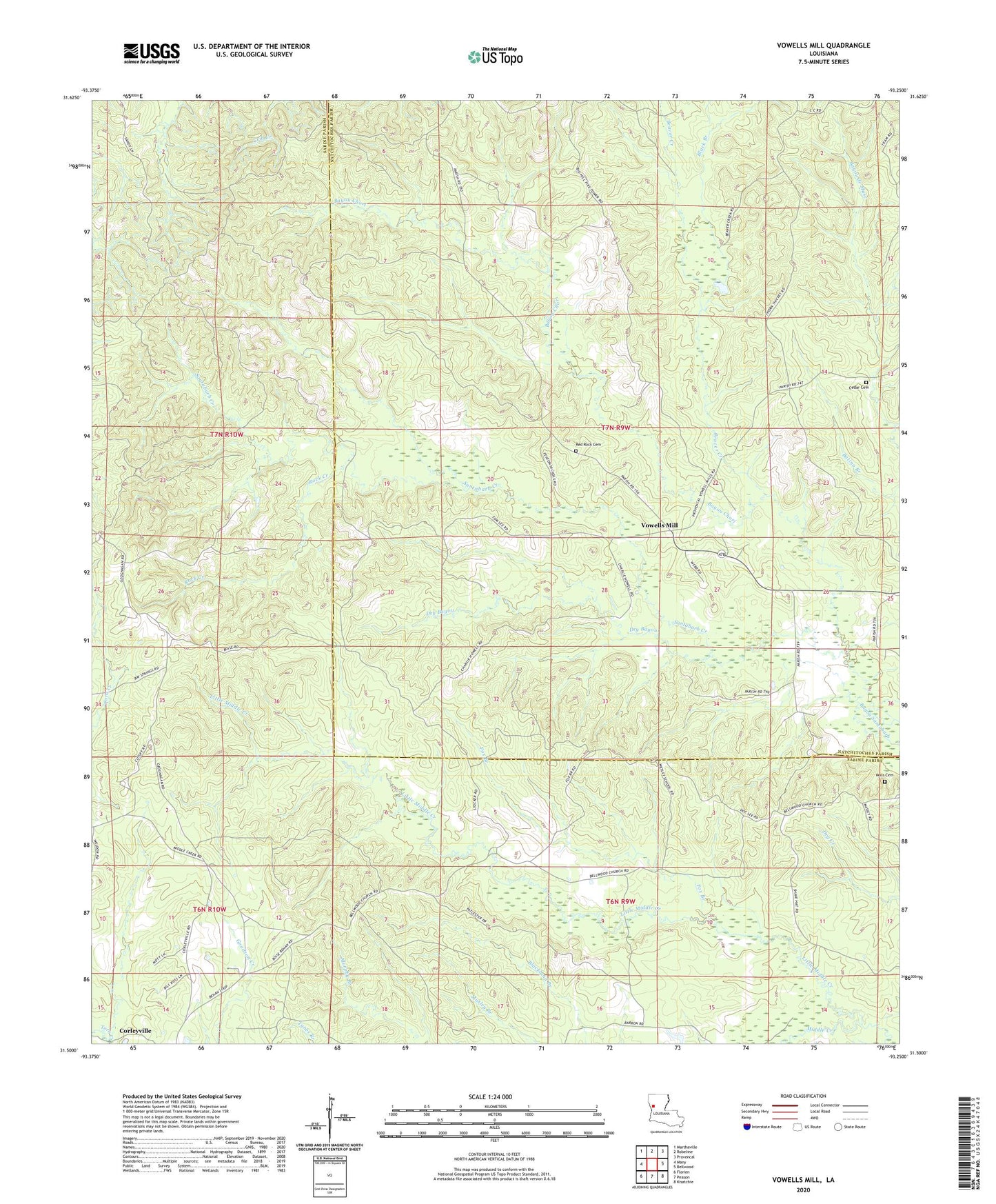
2024 topographic map quadrangle Vowells Mill in the state of Louisiana. Scale: 1:24000. Based on the newly updated USGS 7.5' US Topo map series, this map is in the following counties: Sabine, Natchitoches. The map contains contour data, water features, and other items you are used to seeing on USGS maps, but also has updated roads and other features. This is the next generation of topographic maps. Printed on high-quality waterproof paper with UV fade-resistant inks.
Quads adjacent to this one:
West: Many
Northwest: Marthaville
North: Robeline
Northeast: Provencal
East: Bellwood
Southeast: Kisatchie
South: Peason
Southwest: Florien
This map covers the same area as the classic USGS quad with code o31093e3.
Contains the following named places: Bay Spring Church, Bayou Chori, Beaver Creek, Black Branch, Cedar Cemetery, Dry Bayou, Fox Branch, Little Middle Creek, Middle Creek Church, Middle Creek School, Moss Cemetery, Red Rock Cemetery, Rock Creek, Santabarb Creek, Vowells Mill