MyTopo
Provencal Louisiana US Topo Map
Couldn't load pickup availability
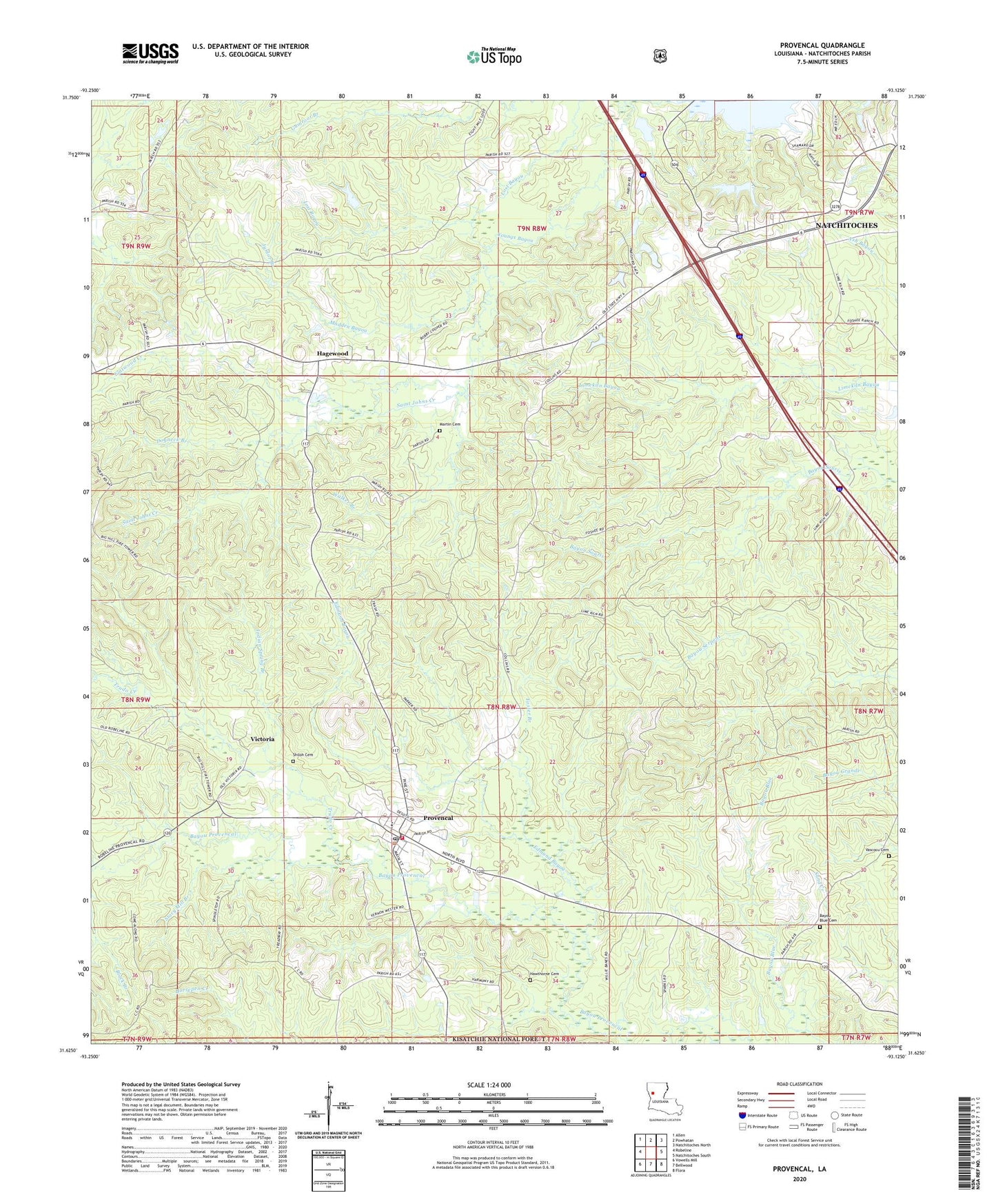
2020 topographic map quadrangle Provencal in the state of Louisiana. Scale: 1:24000. Based on the newly updated USGS 7.5' US Topo map series, this map is in the following counties: Natchitoches. The map contains contour data, water features, and other items you are used to seeing on USGS maps, but also has updated roads and other features. This is the next generation of topographic maps. Printed on high-quality waterproof paper with UV fade-resistant inks.
Quads adjacent to this one:
West: Robeline
Northwest: Allen
North: Powhatan
Northeast: Natchitoches North
East: Natchitoches South
Southeast: Flora
South: Bellwood
Southwest: Vowells Mill
Contains the following named places: Bayou Blue Cemetery, Beechwood Estates, Black Branch, Breedlove Hills, Coal Kiln Creek, Coldwater Church, Dogneck Branch, Edmund Bayou, Emmanuel Church, Flatwood Creek, Foster Branch, Hagewood, Hawthorne Cemetery, Indian Spring Branch, Junior Branch, Knightville, Lime Kiln School, Limekiln Church, Madden Bayou, Martin Cemetery, Mount Olive Church, New Beulah Church, New Testament Church, Pine Grove Church, Provencal, Provencal Elementary / Junior High School, Provencal Volunteer Fire Department, Saint Johns Creek, Saint Marks Church, Shamard Heights, Shiloh Cemetery, Stacy Mill Branch, Trudo Creek, Vascocu Cemetery, Victoria, Village of Provencal, Walker Branch, Williams Chapel