MyTopo
Powhatan Louisiana US Topo Map
Couldn't load pickup availability
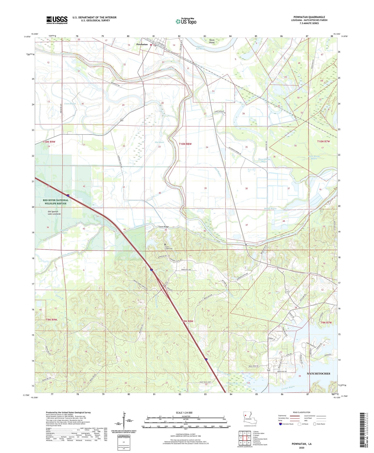
2024 topographic map quadrangle Powhatan in the state of Louisiana. Scale: 1:24000. Based on the newly updated USGS 7.5' US Topo map series, this map is in the following counties: Natchitoches. The map contains contour data, water features, and other items you are used to seeing on USGS maps, but also has updated roads and other features. This is the next generation of topographic maps. Printed on high-quality waterproof paper with UV fade-resistant inks.
Quads adjacent to this one:
West: Allen
Northwest: Hanna
North: Fairview Alpha
Northeast: Campti
East: Natchitoches North
Southeast: Natchitoches South
South: Provencal
Southwest: Robeline
This map covers the same area as the classic USGS quad with code o31093g2.
Contains the following named places: Bayou Pierre, Berean Church, Berry Bridge, Bethel Church, Boggy Bayou, Breedlove Branch, Calvary Church, Calvert Acres, Chute Bridge, Coon Slough, Fairview Acres, Flat River, Forest, Gibson Ditch, Gooch School, Greenwood Park, Gumroot Branch, Highland Acres, House of Faith Church, Johnson Chute, KSBH-FM (Coushatta), Little River, Lost Bayou, Middle Bayou, Natchitoches Country Club, Natchitoches Fire Protection District 10, New Zion Church, North Star Church, Oak Grove, Oak Grove Church, Oakhill, Oakleaf Estates, Old Spanish Lake Lowlands, Oldriver Red River, Parish Governing Authority District 4, Passoit Lake, Posey Branch, Powhatan, Red Bayou, Rio Hondo, Saint Francis Church, Saint John Church, Saint Lukes Cemetery, Saint Lukes Church, Stephens, Tabernacle School, Three League Bayou, Village of Powhatan, Westlake