MyTopo
Ruston East Louisiana US Topo Map
Couldn't load pickup availability
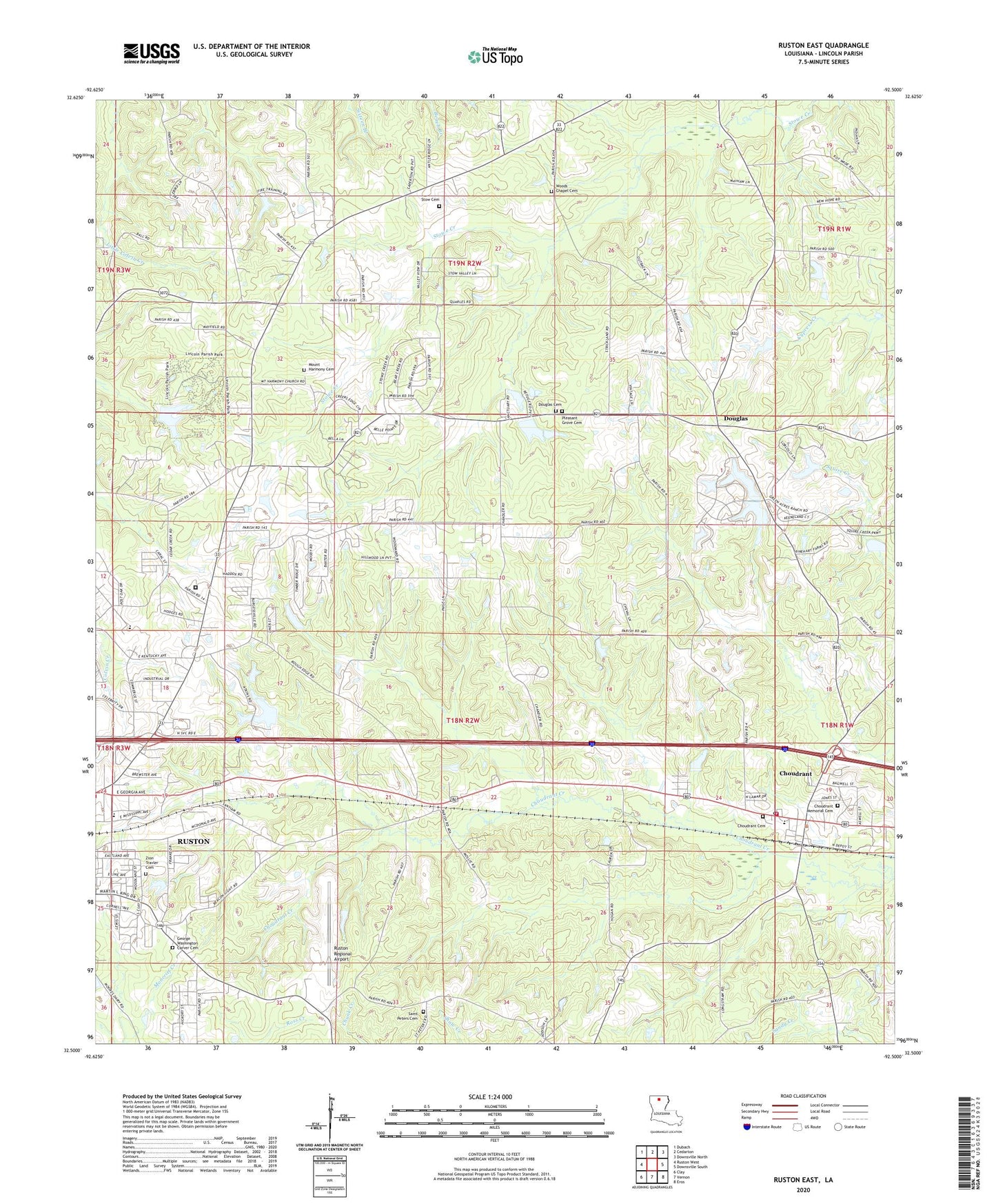
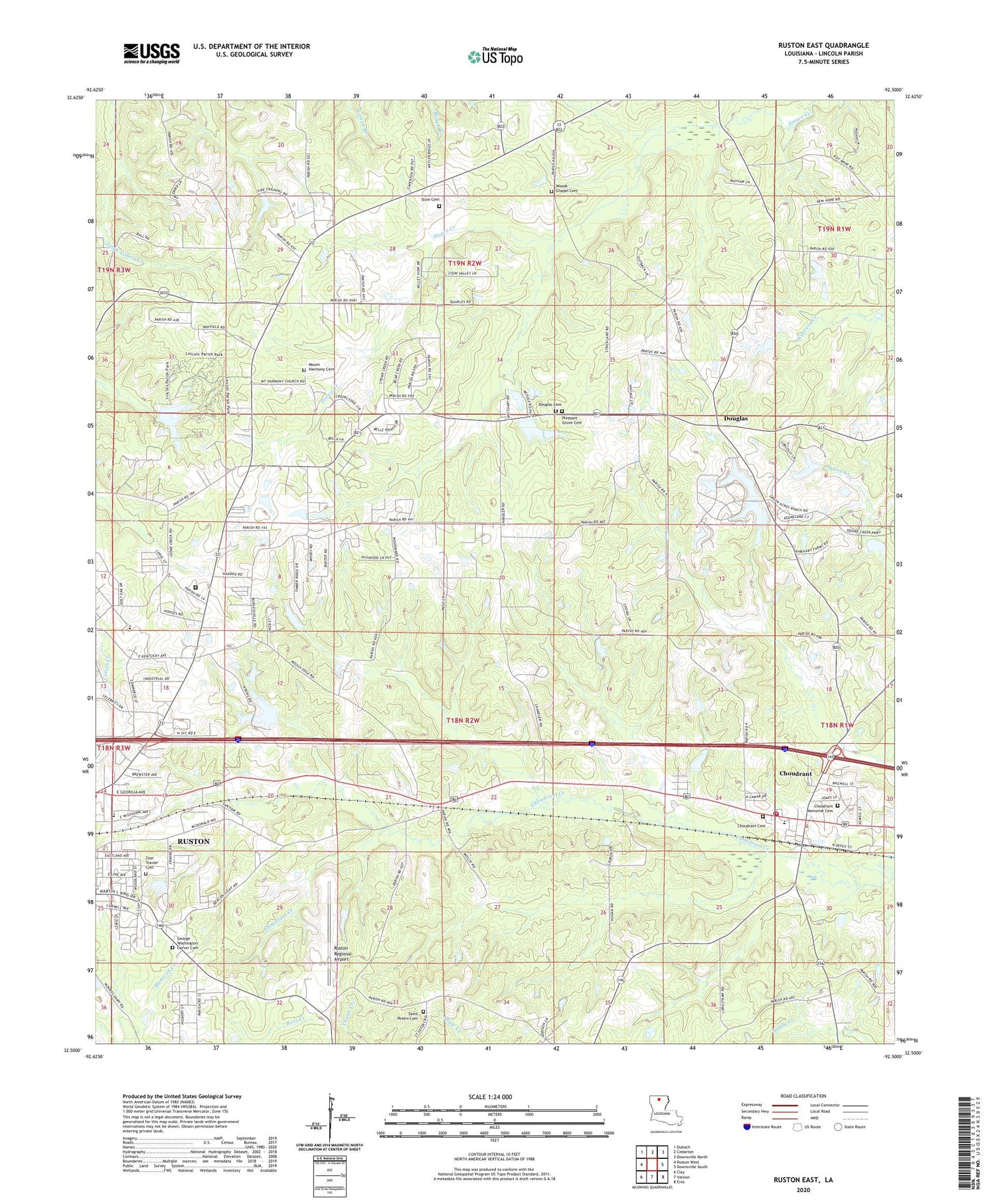
2020 topographic map quadrangle Ruston East in the state of Louisiana. Scale: 1:24000. Based on the newly updated USGS 7.5' US Topo map series, this map is in the following counties: Lincoln. The map contains contour data, water features, and other items you are used to seeing on USGS maps, but also has updated roads and other features. This is the next generation of topographic maps. Printed on high-quality waterproof paper with UV fade-resistant inks.
Quads adjacent to this one:
West: Ruston West
Northwest: Dubach
North: Cedarton
Northeast: Downsville North
East: Downsville South
Southeast: Eros
South: Vernon
Southwest: Clay
Contains the following named places: Ball School, Burgessville, Cedar Creek School, Chamber of Commerce Industrial Park, Choudrant, Choudrant Gas Field, Choudrant High School, Choudrant Post Office, Choudrant United Methodist Church, Choudrant Volunteer Fire Department, Douglas, Douglas Cemetery, Douglas Pond Dam, Douglas United Methodist Church, Ebenezer Church of God in Christ, Ephesus Primitive Baptist Church, First Baptist Church, Mount Harmony Baptist Church, Mount Harmony School, Parish Governing Authority District 10, Parish Governing Authority District 1B, Parish Governing Authority District 1C, Parish Governing Authority District 1D, Parish Governing Authority District 8, Ruston Elementary School, Ruston Gas Field, Ruston Regional Airport, Saint Peter Baptist Church, Snowden School, Sumpter, Village of Choudrant, Ward Five, Woody School