MyTopo
Downsville North Louisiana US Topo Map
Couldn't load pickup availability
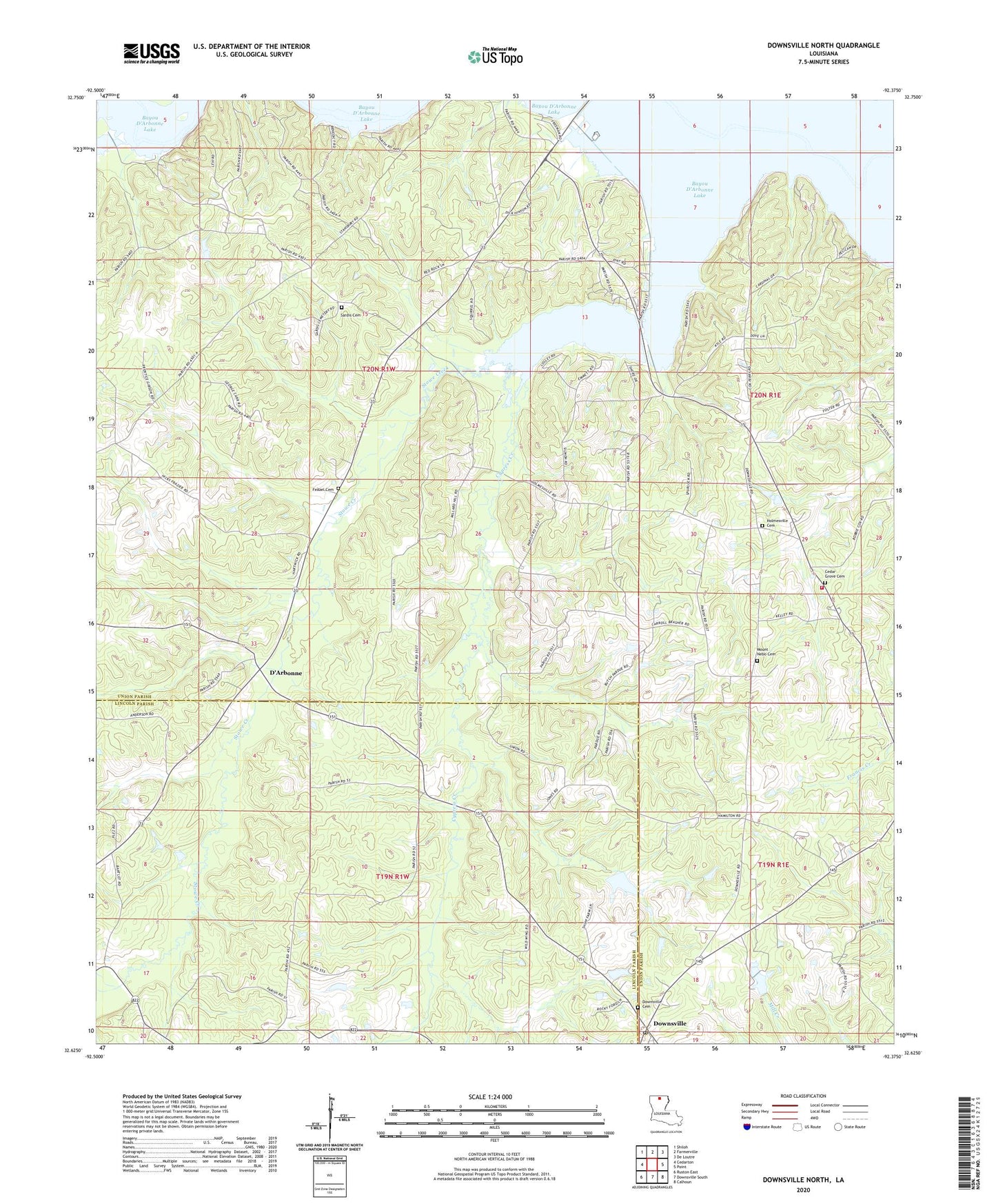
2024 topographic map quadrangle Downsville North in the state of Louisiana. Scale: 1:24000. Based on the newly updated USGS 7.5' US Topo map series, this map is in the following counties: Union, Lincoln. The map contains contour data, water features, and other items you are used to seeing on USGS maps, but also has updated roads and other features. This is the next generation of topographic maps. Printed on high-quality waterproof paper with UV fade-resistant inks.
Quads adjacent to this one:
West: Cedarton
Northwest: Shiloh
North: Farmerville
Northeast: De Loutre
East: Point
Southeast: Calhoun
South: Downsville South
Southwest: Ruston East
This map covers the same area as the classic USGS quad with code o32092f4.
Contains the following named places: Bayou D'Arbonne Gas Field, Bethel Church, Boggy Branch, Cane Creek, Cedar Grove Cemetery, Cox Ferry, Cypress Creek, D'Arbonne, D'Arbonne Gas Field, D'Arbonne Lookout Tower, Downsville, Downsville Cemetery, Feazel Cemetery, Holmesville, Holmesville Cemetery, Holmesville Church, Hopewell School, Millard Hill Church, Millard Hill School, Mount Nebo Church, Mount Zion Church, Saint Pauls Church, Sardis Cemetery, Sardis Church, Stowe Creek, Stowe Creek Gas Field, Terral Cemetery, Village of Downsville, Ward 5 Volunteer Fire Department, Woodlawn Church