MyTopo
Dubach Louisiana US Topo Map
Couldn't load pickup availability
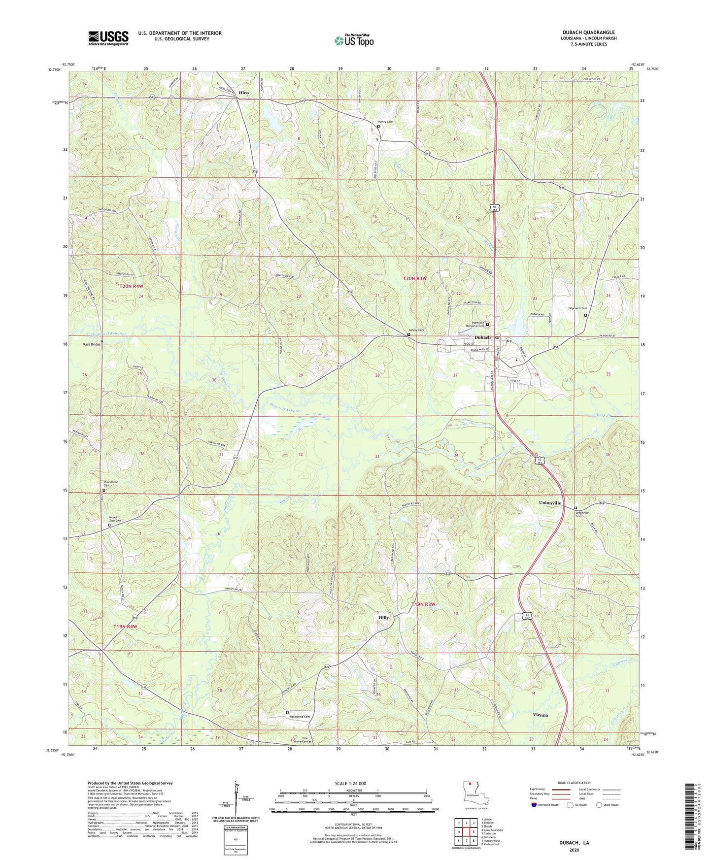
2024 topographic map quadrangle Dubach in the state of Louisiana. Scale: 1:24000. Based on the newly updated USGS 7.5' US Topo map series, this map is in the following counties: Lincoln. The map contains contour data, water features, and other items you are used to seeing on USGS maps, but also has updated roads and other features. This is the next generation of topographic maps. Printed on high-quality waterproof paper with UV fade-resistant inks.
Quads adjacent to this one:
West: Lake Foursome
Northwest: Lisbon
North: Bernice
Northeast: Shiloh
East: Cedarton
Southeast: Ruston East
South: Ruston West
Southwest: Simsboro
This map covers the same area as the classic USGS quad with code o32092f6.
Contains the following named places: Autrey Cemetery, Big Creek, Buck Branch, Dubach, Dubach High School, Dubach Police Department, Dubach Post Office, Dubach United Methodist Church, First Baptist Church, Grace Baptist Church, Greensboro, Henry, Henry Cemetery, Hico, Hico Baptist Church, Hico Elementary School, Hico Gas Field, Hico School, Hilly, Hilly Lookout Tower, Hopewell Cemetery, Hopewell Church, Knowles Oil and Gas Field, KPCH-FM (Dubach), Lake Dubach Dam, Larance Ferry, Macedonia School, Mays Bridge, Middlefork Gas Field, Mount Zion, Mount Zion Number 2 Baptist Church, New Prospect Baptist Church, Parish Governing Authority District 4, Pine Grove Cemetery, Providence Cemetery, Town of Dubach, Turkey Creek, Unionville, Vining Mills, Wafer Creek, Ward Four, Wise, ZIP Code: 71235