MyTopo
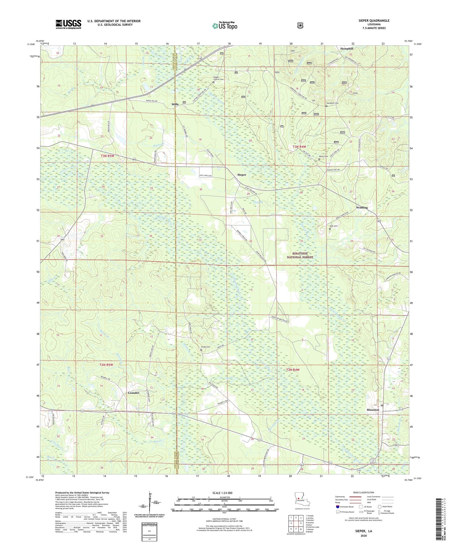
Sieper Louisiana US Topo Map
Couldn't load pickup availability
Also explore the Sieper Forest Service Topo of this same quad for updated USFS data
2024 topographic map quadrangle Sieper in the state of Louisiana. Scale: 1:24000. Based on the newly updated USGS 7.5' US Topo map series, this map is in the following counties: Rapides, Vernon. The map contains contour data, water features, and other items you are used to seeing on USGS maps, but also has updated roads and other features. This is the next generation of topographic maps. Printed on high-quality waterproof paper with UV fade-resistant inks.
Quads adjacent to this one:
West: Lacamp
Northwest: Temple
North: Jericho
Northeast: Gardner
East: Elmer
Southeast: Melder
South: Afeman
Southwest: Fullerton Lake
This map covers the same area as the classic USGS quad with code o31092b7.
Contains the following named places: Big Creek, Big Hammock Church, Big Hammock School, Burns Cemetery, Clifton Crossing, Comrade Creek, Cypress Bayou, Dan Branch, Dixie Baptist Church, Dixie School, Gum Branch, Hardshell Cemetery, Hemphill, Hineston, Hineston Branch, Hineston Post Office, Holt Cemetery, Houge Branch, Howell Branch, Leander, Leander Church, Leander Post Office, Little Dry Creek, Majors Branch, Merchant Branch, Mill Creek, Mineral Branch, Muse, Nichols Landing Strip, Pisgah Church Cemetery, Price Crossing, Roland Airport, Saint Jude Church, Sieper, Sieper Creek, Sieper Post Office, Smith Cemetery, Stille, Twin Oak Church, Walding, ZIP Code: 71472