MyTopo
Temple Louisiana US Topo Map
Couldn't load pickup availability
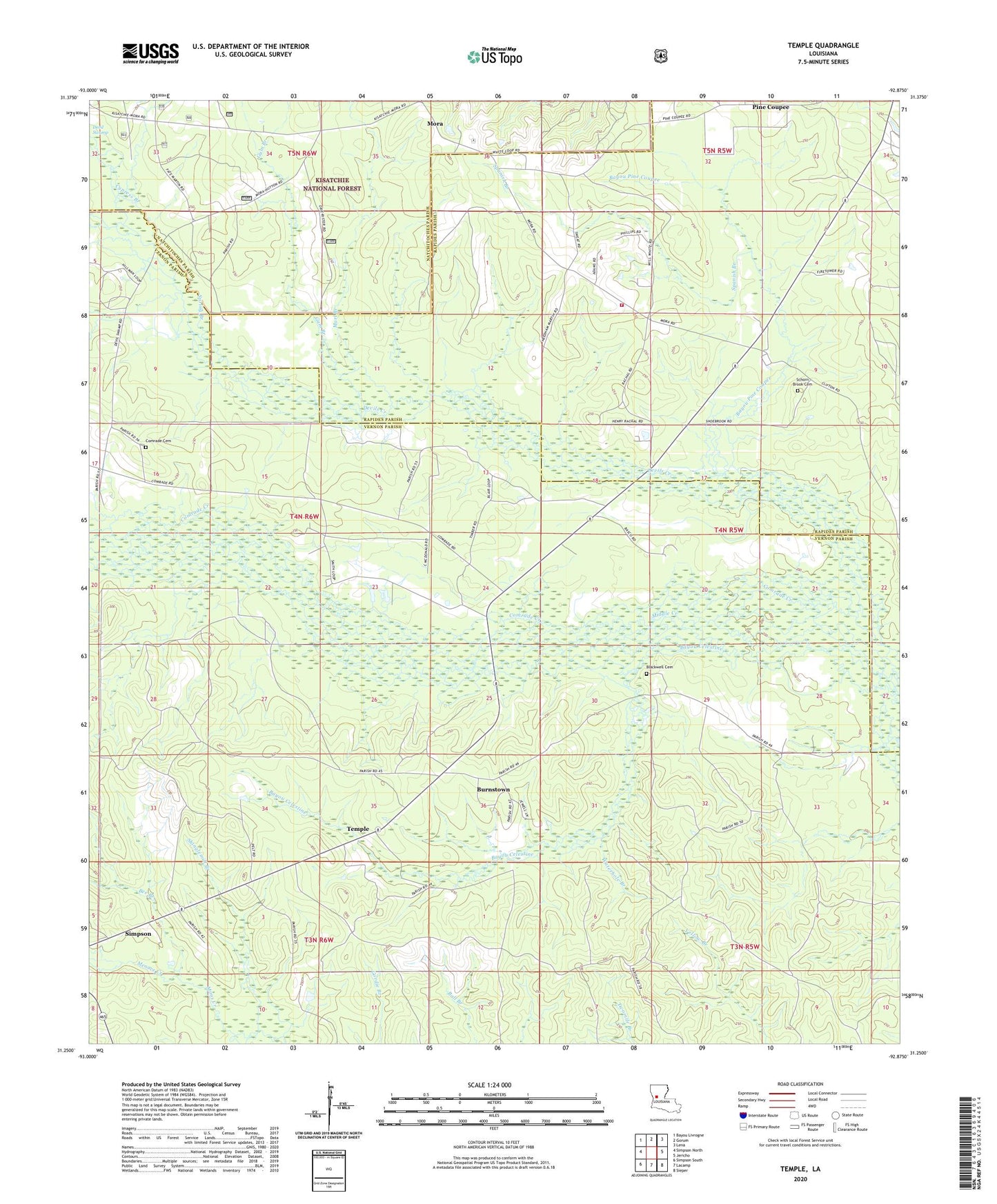
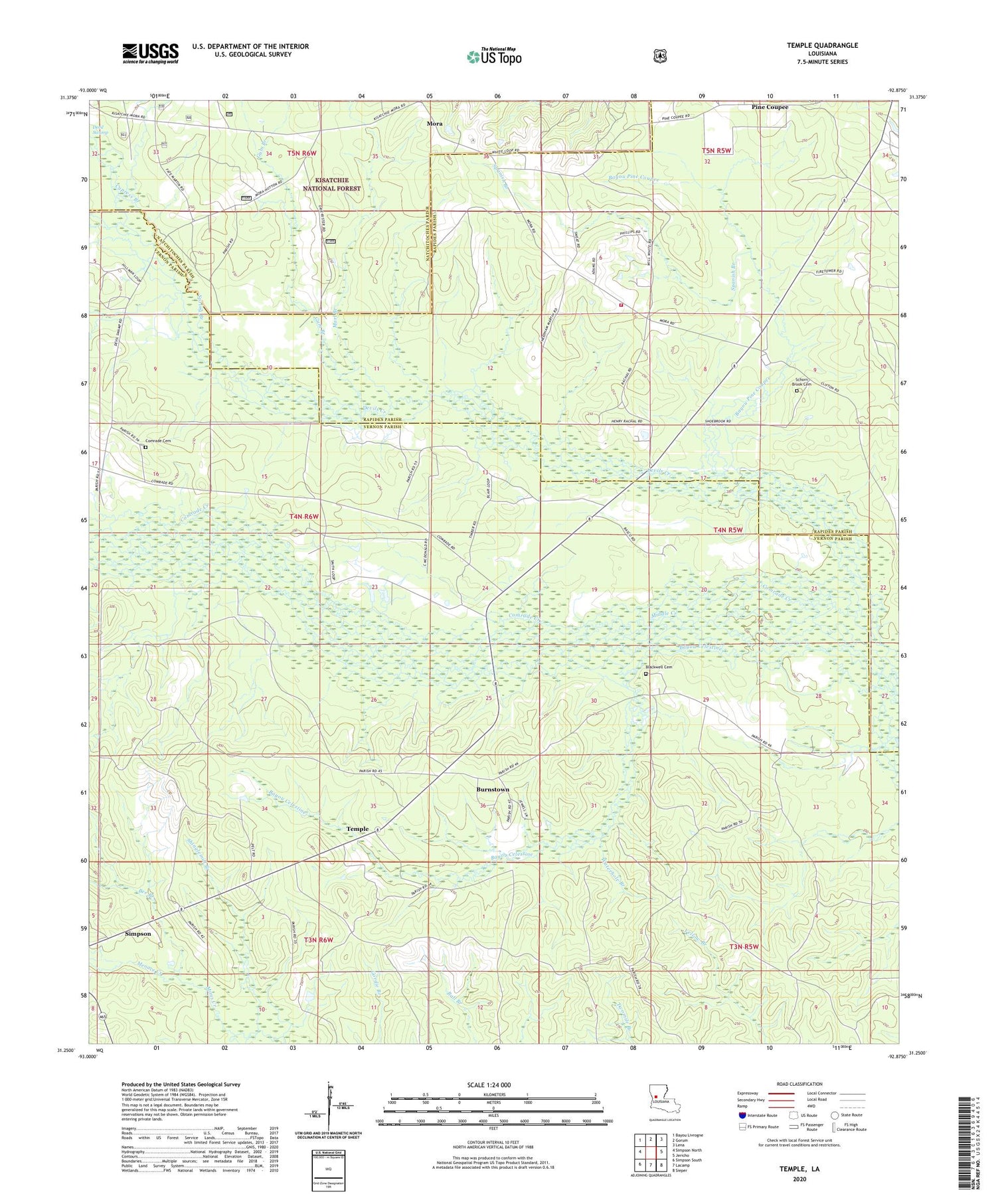
2020 topographic map quadrangle Temple in the state of Louisiana. Scale: 1:24000. Based on the newly updated USGS 7.5' US Topo map series, this map is in the following counties: Vernon, Rapides, Natchitoches. The map contains contour data, water features, and other items you are used to seeing on USGS maps, but also has updated roads and other features. This is the next generation of topographic maps. Printed on high-quality waterproof paper with UV fade-resistant inks.
Quads adjacent to this one:
West: Simpson North
Northwest: Bayou Livrogne
North: Gorum
Northeast: Lena
East: Jericho
Southeast: Sieper
South: Lacamp
Southwest: Simpson South
Contains the following named places: Bayou Celestine, Bayou Pine Coupee, Bee Branch, Blackwell Cemetery, Burnstown, Comrade, Comrade Cemetery, Comrade Church, Cypress Branch, Devils Creek, Elliot School, Flatwoods Volunteer Fire Department Station 2, Gum Branch, Hood, Jacksonville, Marl Branch, Menace Creek, Middle Creek, Mora, Mora Post Office, Mora School, Pentecost Church, Pine Coupee, Pine Grove Church, Red Top Church, Schorn Brook Cemetery, Shinglemill Branch, Spanish Branch, Spanish Branch Church, Spring Branch, Temple, Temple Spur, Ward Six, Waterhole Branch, Zimmerman Camp