MyTopo
Panther Lake Louisiana US Topo Map
Couldn't load pickup availability
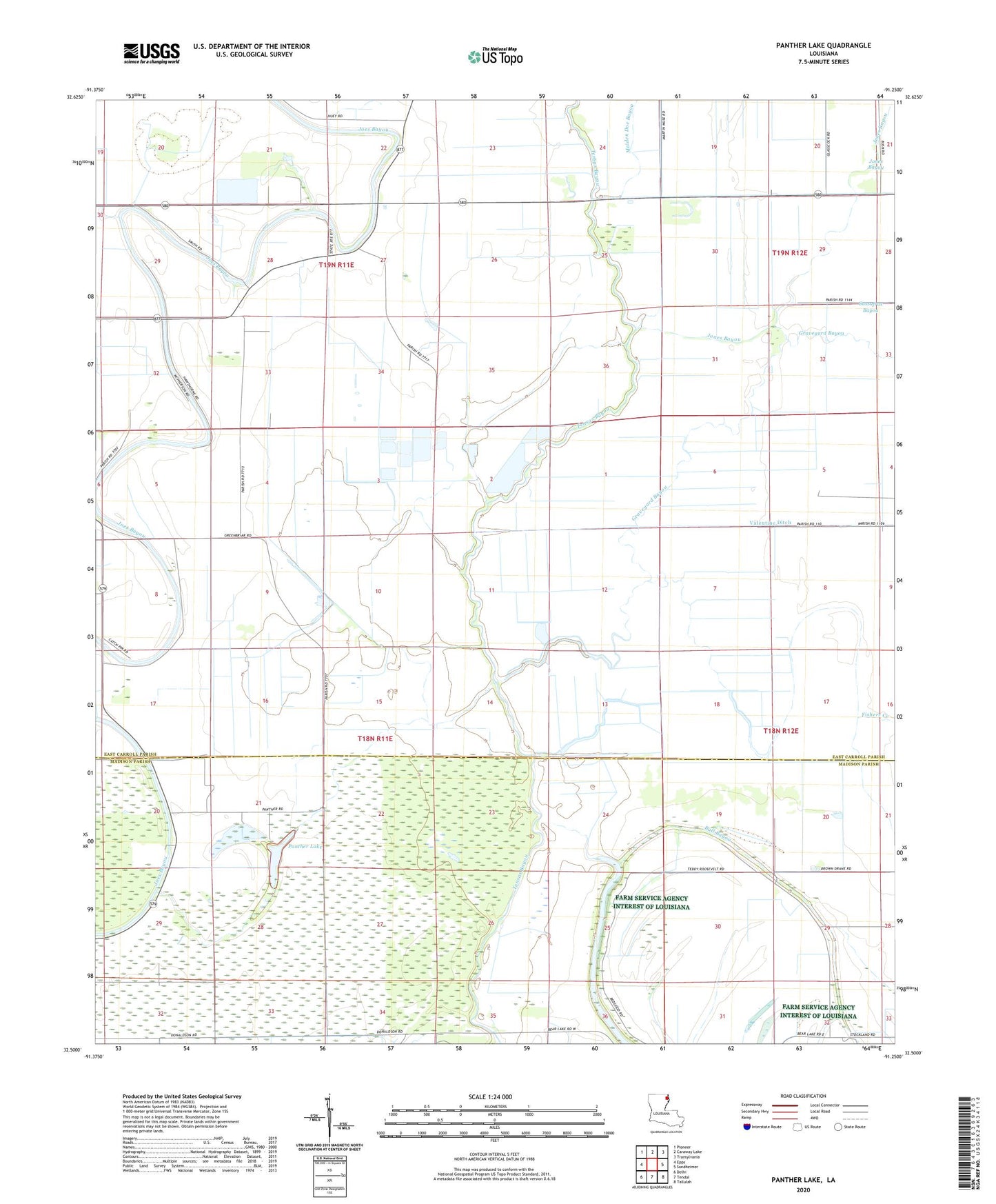
2024 topographic map quadrangle Panther Lake in the state of Louisiana. Scale: 1:24000. Based on the newly updated USGS 7.5' US Topo map series, this map is in the following counties: East Carroll, Madison. The map contains contour data, water features, and other items you are used to seeing on USGS maps, but also has updated roads and other features. This is the next generation of topographic maps. Printed on high-quality waterproof paper with UV fade-resistant inks.
Quads adjacent to this one:
West: Epps
Northwest: Pioneer
North: Caraway Lake
Northeast: Transylvania
East: Sondheimer
Southeast: Tallulah
South: Tendal
Southwest: Delhi
This map covers the same area as the classic USGS quad with code o32091e3.
Contains the following named places: Graveyard Bayou, Jones Bayou, Maiden Doe Bayou, New Hope Church, Panther Lake, Sassafras Bayou, Valentine Ditch