
MyTopo
Tullos Louisiana US Topo Map
Couldn't load pickup availability
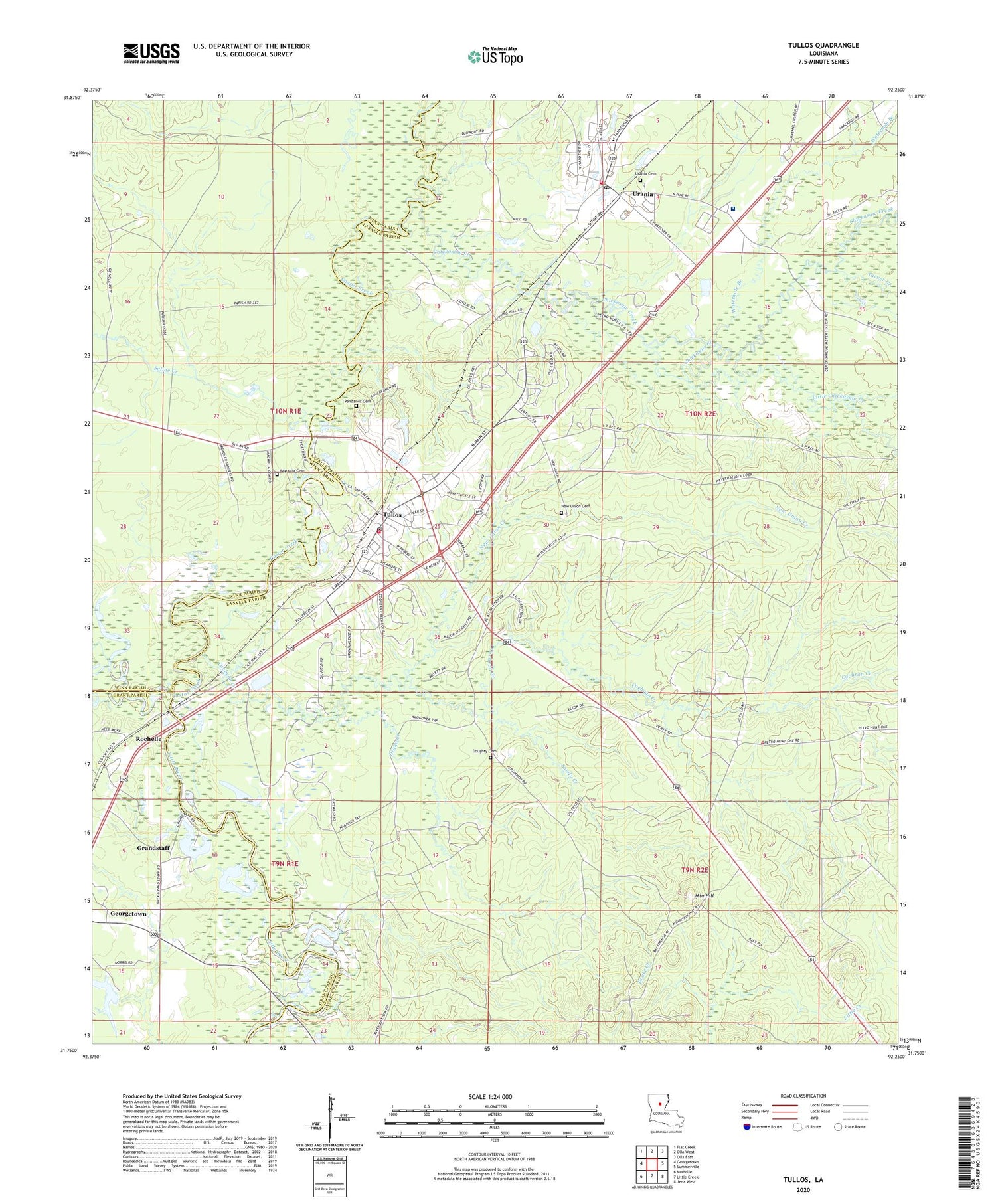
2020 topographic map quadrangle Tullos in the state of Louisiana. Scale: 1:24000. Based on the newly updated USGS 7.5' US Topo map series, this map is in the following counties: LaSalle, Winn, Grant. The map contains contour data, water features, and other items you are used to seeing on USGS maps, but also has updated roads and other features. This is the next generation of topographic maps. Printed on high-quality waterproof paper with UV fade-resistant inks.
Quads adjacent to this one:
West: Georgetown
Northwest: Flat Creek
North: Olla West
Northeast: Olla East
East: Summerville
Southeast: Jena West
South: Little Creek
Southwest: Mudville
Contains the following named places: Bay Springs Lookout Tower, Castor Creek, Castor Salt Lick, Chickasaw Creek, Cochran Creek, Doughty Cemetery, Drake Creek, Dugdemona River, Georgetown Water Supply, Georgetown Water Supply Dam, Grandstaff, Grant, Hardtner Medical Center, Hardtner Medical Center Heliport, LaSalle Junior High School, Little Chickasaw Creek, Magnolia Cemetery, Mountain Hill, New Union Cemetery, New Union Creek, New Union Missionary Baptist Church, Parish Governing Authority District 3, Pendarvis Cemetery, Pendarvis Landing, Rochelle, Saline Creek, Sandy Creek, Tarver Creek, Town of Tullos, Town of Urania, Tullos, Tullos Elementary School, Tullos Post Office, Tullos School, Tullos Urania Oil Field, Tullos Volunteer Fire Department, Urania, Urania Cemetery, Urania Elementary School, Urania High School, Urania Post Office, Urania Volunteer Fire Department, Ward Three, Waterhole Branch, Wayside Church, ZIP Codes: 71479, 71480


