MyTopo
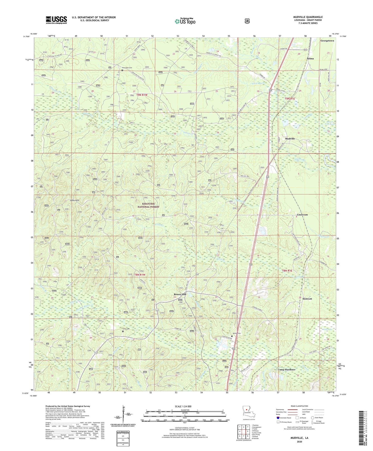
Mudville Louisiana US Topo Map
Couldn't load pickup availability
Also explore the Mudville Forest Service Topo of this same quad for updated USFS data
2024 topographic map quadrangle Mudville in the state of Louisiana. Scale: 1:24000. Based on the newly updated USGS 7.5' US Topo map series, this map is in the following counties: Grant. The map contains contour data, water features, and other items you are used to seeing on USGS maps, but also has updated roads and other features. This is the next generation of topographic maps. Printed on high-quality waterproof paper with UV fade-resistant inks.
Quads adjacent to this one:
West: Williana
Northwest: Packton
North: Georgetown
Northeast: Tullos
East: Little Creek
Southeast: Fishville
South: Pollock
Southwest: Dry Prong
This map covers the same area as the classic USGS quad with code o31092f4.
Contains the following named places: Alligator Branch, Andalusia Church, Bear Creek, Breezy Hill, Camp Hardtner, Carson Branch, Clear Branch, Cross Bayou, Cypress Creek, Devils Brake, Gray Branch, Gray Cemetery, Howcott, Jesse Branch, Johns Hills, Kees Branch, Lincecum, Louisiana Noname Number 56 Dam, McKay Branch, McKay Cemetery, Mill Branch, Mudville, Panther Bayou, Pine Knot Cemetery, Sandy Branch, Selma, Selma Oil Field, ZIP Code: 71432