MyTopo
Little Creek Louisiana US Topo Map
Couldn't load pickup availability
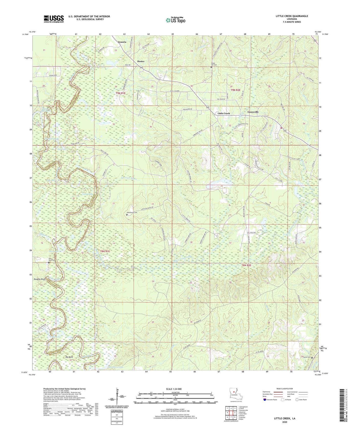
2024 topographic map quadrangle Little Creek in the state of Louisiana. Scale: 1:24000. Based on the newly updated USGS 7.5' US Topo map series, this map is in the following counties: LaSalle, Grant. The map contains contour data, water features, and other items you are used to seeing on USGS maps, but also has updated roads and other features. This is the next generation of topographic maps. Printed on high-quality waterproof paper with UV fade-resistant inks.
Quads adjacent to this one:
West: Mudville
Northwest: Georgetown
North: Tullos
Northeast: Summerville
East: Jena West
Southeast: Nebo
South: Fishville
Southwest: Pollock
This map covers the same area as the classic USGS quad with code o31092f3.
Contains the following named places: Bay Spring Lookout Tower, Bayou Funny Louis, Big Bend, Big Bend School, Boston Fool River, Campbells Ferry, Chalk Hill Cemetery, Dayton Cemetery, Doughty Bluff, Ebenezer Baptist Church, Ebenezer School, Fish Creek, Ganeyville, Gilmore Church, Hawthorne Cemetery, Hester, Horseshoe Lake, Hub Lake, Indian Creek, Jones Creek, Kitchen Creek, Lacroix Creek, Lincecum Bayou, Little Bayou Oil Field, Little Creek, Little Creek - Searcy Volunteer Fire Department, Little Creek Oil Field, Moon Lake, North Searcy Gas Field, Nugent Brake, Pine Bluff Cemetery, Pine Lake, Rambeaus Ferry, Round Lake, Sulphur Creek, Thayer School, West Searcy Oil Field, Woodward Lake, Zenoria, Zenoria Baptist Church, ZIP Code: 71371