
MyTopo
Twin Oaks Louisiana US Topo Map
Couldn't load pickup availability
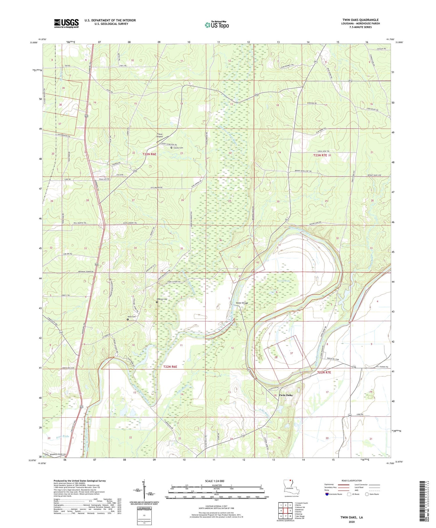
2020 topographic map quadrangle Twin Oaks in the state of Louisiana. Scale: 1:24000. Based on the newly updated USGS 7.5' US Topo map series, this map is in the following counties: Morehouse. The map contains contour data, water features, and other items you are used to seeing on USGS maps, but also has updated roads and other features. This is the next generation of topographic maps. Printed on high-quality waterproof paper with UV fade-resistant inks.
Quads adjacent to this one:
West: Beekman
Northwest: Crossett South
North: Berlin
Northeast: Wilmot SW
East: Bonita
Southeast: Bonita SW
South: Mer Rouge
Southwest: Bastrop
Contains the following named places: Bartholomew Church, Beekman Lookout Tower, Bethel Baptist Church, Brodnax, Caney Bayou, Causey, Causey Cemetery, Chemin A Haut Lake Dam, Chemin-A-Haut Bayou, Chemin-A-Haut State Park, Concord Church, Harrell Brake, Holly Green Church, Kelly Cemetery, Morehouse Brake, Neamon Cemetery, New Light Church, Nunn Brake, Parish Governing Authority District 1, Plantersville, Tillou Church, Tipton, Travis Airport, Twin Oaks, Vester Bridge, Ward Nine, Ward Seven


