MyTopo
Mer Rouge Louisiana US Topo Map
Couldn't load pickup availability
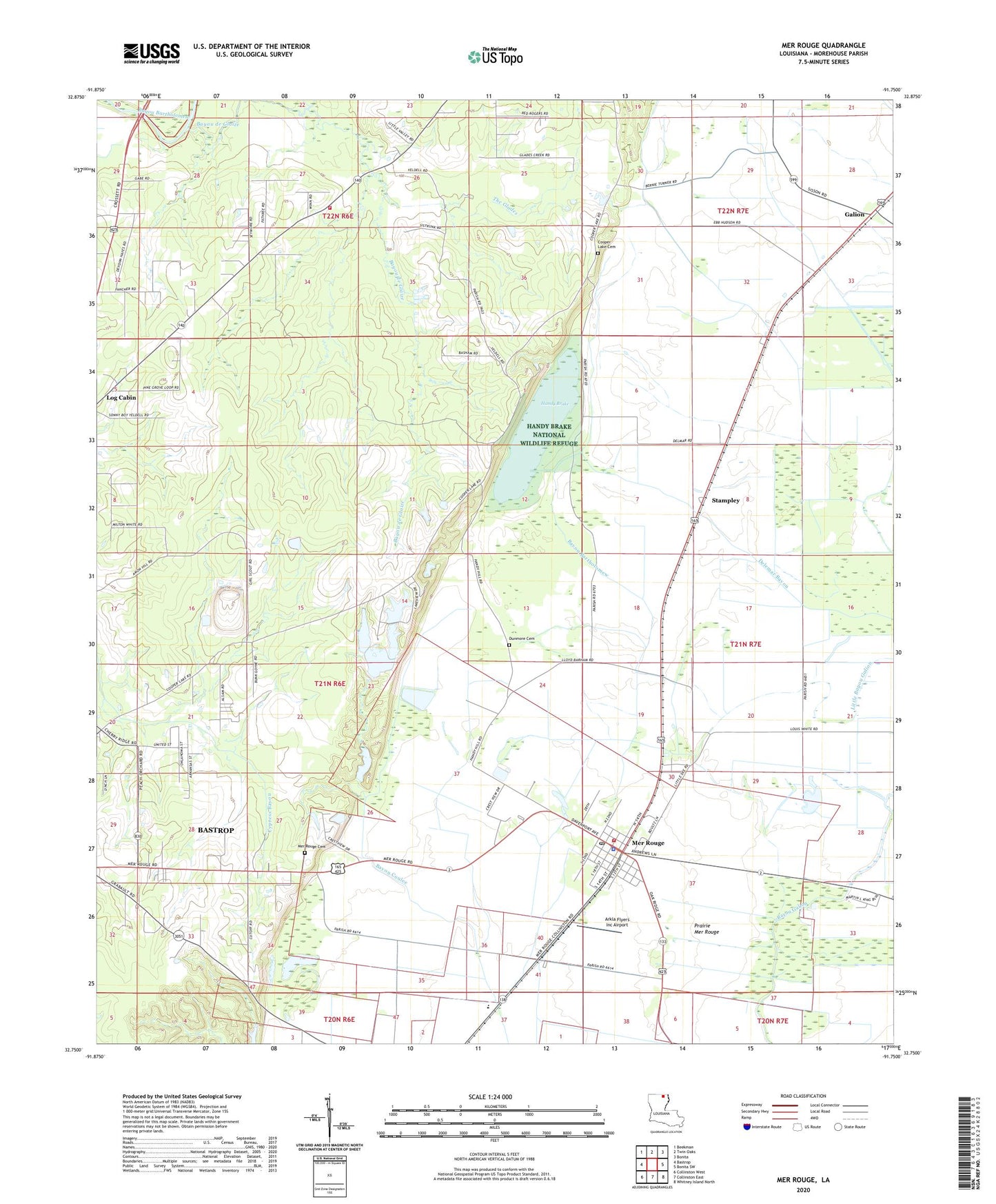
2024 topographic map quadrangle Mer Rouge in the state of Louisiana. Scale: 1:24000. Based on the newly updated USGS 7.5' US Topo map series, this map is in the following counties: Morehouse. The map contains contour data, water features, and other items you are used to seeing on USGS maps, but also has updated roads and other features. This is the next generation of topographic maps. Printed on high-quality waterproof paper with UV fade-resistant inks.
Quads adjacent to this one:
West: Bastrop
Northwest: Beekman
North: Twin Oaks
Northeast: Bonita
East: Bonita SW
Southeast: Whitney Island North
South: Collinston East
Southwest: Collinston West
This map covers the same area as the classic USGS quad with code o32091g7.
Contains the following named places: Arkla Flyers Inc Airport, Bastrop, Bastrop Fire Department Station 4, Bayou de Glaize, Cooper Lake, Cooper Lake Cemetery, Delta Elementary School, Dunmore Cemetery, Galion, Handy Brake, Handy Brake National Wildlife Refuge, Hillview Church, Jelks Bayou, Little Bayou Galion, Mer Rouge, Mer Rouge Cemetery, Mer Rouge Elementary School, Mer Rouge Police Department, Mer Rouge Post Office, Mer Rouge Volunteer Fire Department, Morehouse Parish, Moses Temple, New Baptist Church, Parish Governing Authority District 3, Pine Grove Elementary School, Prairie Mer Rouge, Saint Matthew Church Number 2, Saint Matthew School, Stampley, The Glades, Village of Mer Rouge, Ward Six, Wards Ferry, Washington Chapel