MyTopo
Bonita Louisiana US Topo Map
Couldn't load pickup availability
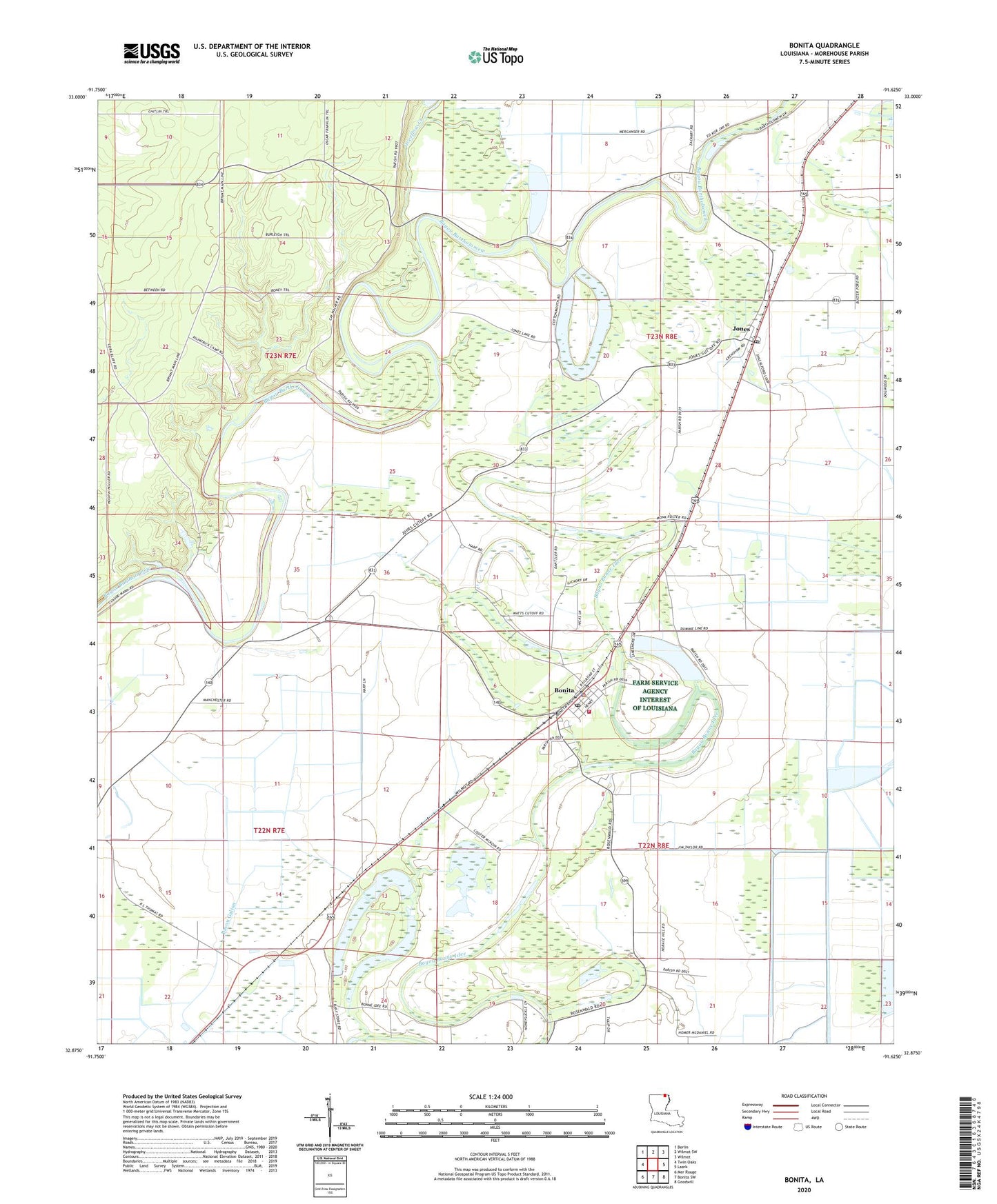
2024 topographic map quadrangle Bonita in the state of Louisiana. Scale: 1:24000. Based on the newly updated USGS 7.5' US Topo map series, this map is in the following counties: Morehouse. The map contains contour data, water features, and other items you are used to seeing on USGS maps, but also has updated roads and other features. This is the next generation of topographic maps. Printed on high-quality waterproof paper with UV fade-resistant inks.
Quads adjacent to this one:
West: Twin Oaks
Northwest: Berlin
North: Wilmot SW
Northeast: Wilmot
East: Laark
Southeast: Goodwill
South: Bonita SW
Southwest: Mer Rouge
This map covers the same area as the classic USGS quad with code o32091h6.
Contains the following named places: 10th Ward Fire District 1 Bonita Volunteer Fire Department, 71223, Assembly of God Church, Bonita, Bonita Elementary School, Bonita Police Department, Bonita Post Office, Green Grove Church, Haynes Landing, Horseshoe Brake Dam, Horseshoe Lake, Jones, Jones Post Office, Lawson Chapel, Loverett Ferry, Mounds Church, New Landgrove Landing, New Saint Mary Church, Oak Landing, Overflow Creek, Saint Luke Church, Shackleford Lake Dam, Shady Grove Church, Victory Missionary Church, Village of Bonita, Ward Ten, Zachery Church