MyTopo
Vixen Louisiana US Topo Map
Couldn't load pickup availability
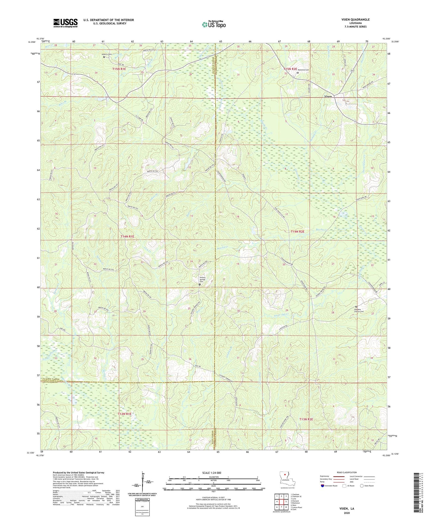
2020 topographic map quadrangle Vixen in the state of Louisiana. Scale: 1:24000. Based on the newly updated USGS 7.5' US Topo map series, this map is in the following counties: Caldwell, Jackson, Winn. The map contains contour data, water features, and other items you are used to seeing on USGS maps, but also has updated roads and other features. This is the next generation of topographic maps. Printed on high-quality waterproof paper with UV fade-resistant inks.
Quads adjacent to this one:
West: Womack
Northwest: Chatham
North: Chatham SE
Northeast: Luna
East: Blankston
Southeast: Clark
South: Cotton Plant
Southwest: Sikes
Contains the following named places: Asbury School, Ashberry Missionary Baptist Church, Bear Creek, Brushy Creek, Brushy School, Bull Creek, Caney Creek, Hickory Springs, Hickory Springs Cemetery, Hickory Springs Church, Humble Creek, Hurricane Creek, Ice Branch, Indian Branch, Lick Creek, Lindsey Branch, Moody Creek, New Church, Old New Church Cemetery, Palestine Baptist Church, Palestine Cemetery, Pankey Creek, Seven Runs Crossing, Spring Creek, Sweetwater Creek, Vixen, White Oak Creek