MyTopo
Ashland Maine US Topo Map
Couldn't load pickup availability
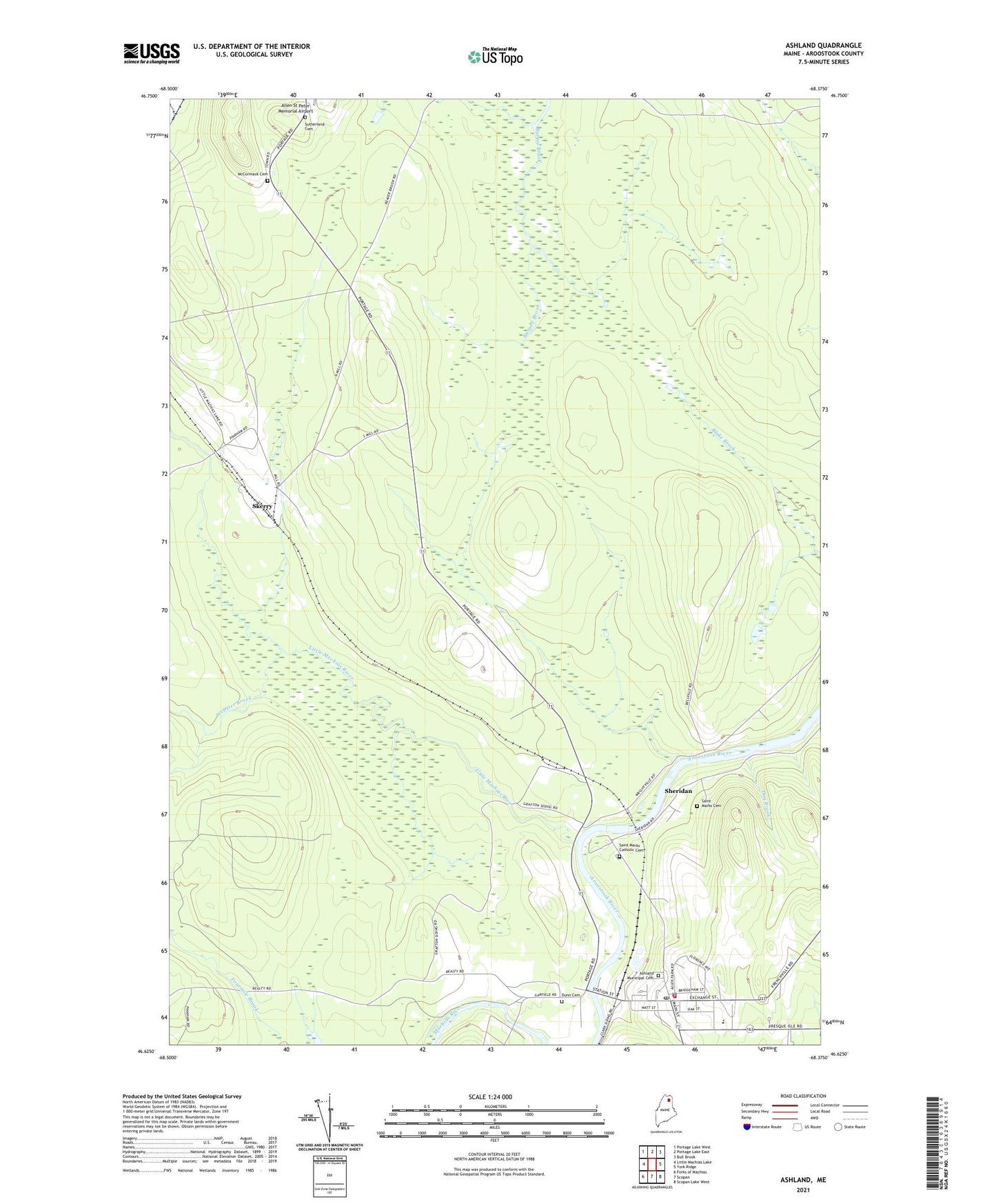
2024 topographic map quadrangle Ashland in the state of Maine. Scale: 1:24000. Based on the newly updated USGS 7.5' US Topo map series, this map is in the following counties: Aroostook. The map contains contour data, water features, and other items you are used to seeing on USGS maps, but also has updated roads and other features. This is the next generation of topographic maps. Printed on high-quality waterproof paper with UV fade-resistant inks.
Quads adjacent to this one:
West: Little Machias Lake
Northwest: Portage Lake West
North: Portage Lake East
Northeast: Bull Brook
East: York Ridge
Southeast: Scopan Lake West
South: Scopan
Southwest: Forks of Machias
This map covers the same area as the classic USGS quad with code o46068f4.
Contains the following named places: Ashland, Ashland Ambulance Service, Ashland Central School, Ashland Community High School, Ashland Community Library, Ashland District School, Ashland Fire Department, Ashland Municipal Cemetery, Ashland Police Department, Ashland Post Office, Dug Brook, Dunn Cemetery, Little Machias River, McCormack Cemetery, Saint Marks Catholic Cemetery, Saint Marks Cemetery, Schoolhouse Brook, Sheridan, Sheridan Post Office, Skerry, Sutherland Cemetery, Webster Brook, Webster Brook Tote Road