
MyTopo
Bowers Mountain Maine US Topo Map
Couldn't load pickup availability
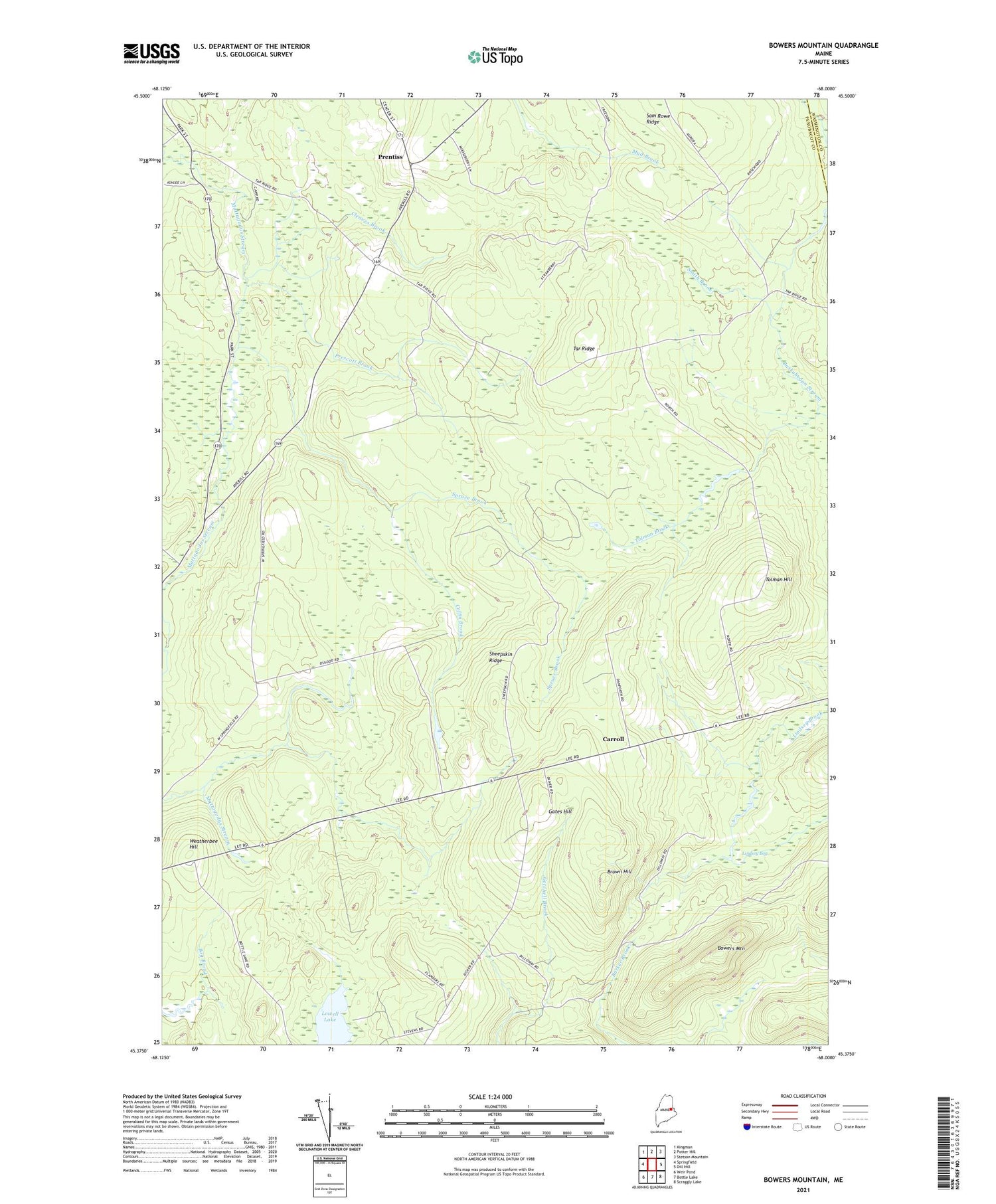
2021 topographic map quadrangle Bowers Mountain in the state of Maine. Scale: 1:24000. Based on the newly updated USGS 7.5' US Topo map series, this map is in the following counties: Penobscot, Washington. The map contains contour data, water features, and other items you are used to seeing on USGS maps, but also has updated roads and other features. This is the next generation of topographic maps. Printed on high-quality waterproof paper with UV fade-resistant inks.
Quads adjacent to this one:
West: Springfield
Northwest: Kingman
North: Potter Hill
Northeast: Stetson Mountain
East: Dill Hill
Southeast: Scraggly Lake
South: Bottle Lake
Southwest: Weir Pond
Contains the following named places: Bowers Mountain, Brown Hill, Carroll, Cleaves Brook, Coffin Brook, Cole School, Gates Hill, Gates School, Lindsey Bog, Lowell Lake, Plantation of Carroll, Prentiss, Prescott Brook, Sam Rowe Ridge, Sheepskin Ridge, Smith Brook, Spruce Brook, Tar Ridge, Tar Ridge School, Thompson Corners, Thompson School, Tolman Brook, Tolman Hill, Tolman School, Tredwell School, Washington School, Weatherbee Hill, White School, ZIP Code: 04487


