MyTopo
Kingman Maine US Topo Map
Couldn't load pickup availability
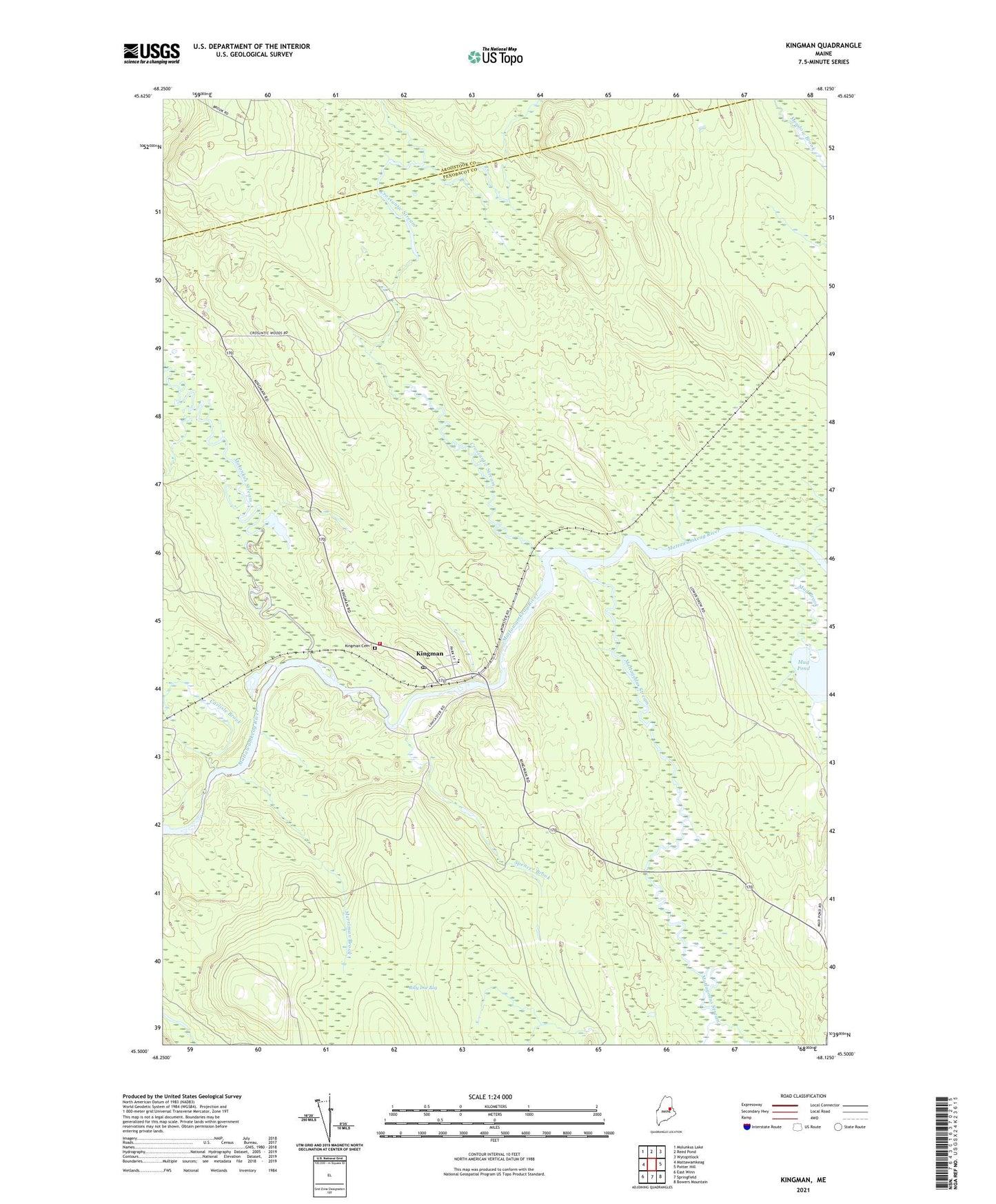
2024 topographic map quadrangle Kingman in the state of Maine. Scale: 1:24000. Based on the newly updated USGS 7.5' US Topo map series, this map is in the following counties: Penobscot, Aroostook. The map contains contour data, water features, and other items you are used to seeing on USGS maps, but also has updated roads and other features. This is the next generation of topographic maps. Printed on high-quality waterproof paper with UV fade-resistant inks.
Quads adjacent to this one:
West: Mattawamkeag
Northwest: Molunkus Lake
North: Reed Pond
Northeast: Wytopitlock
East: Potter Hill
Southeast: Bowers Mountain
South: Springfield
Southwest: East Winn
This map covers the same area as the classic USGS quad with code o45068e2.
Contains the following named places: Billy Doe Bog, Boynton School, Carlisle Brook, Crossuntic Stream, Kingman, Kingman Elementary School, Kingman Post Office, Mattagodus Stream, Merriman Brook, Molunkus Stream, Mud Brook, Spencer Brook, Township of Kingman, Unorganized Territory of Kingman, West Branch Mattagodus Stream, Whitten Brook, ZIP Code: 04451