MyTopo
Brewer Lake Maine US Topo Map
Couldn't load pickup availability
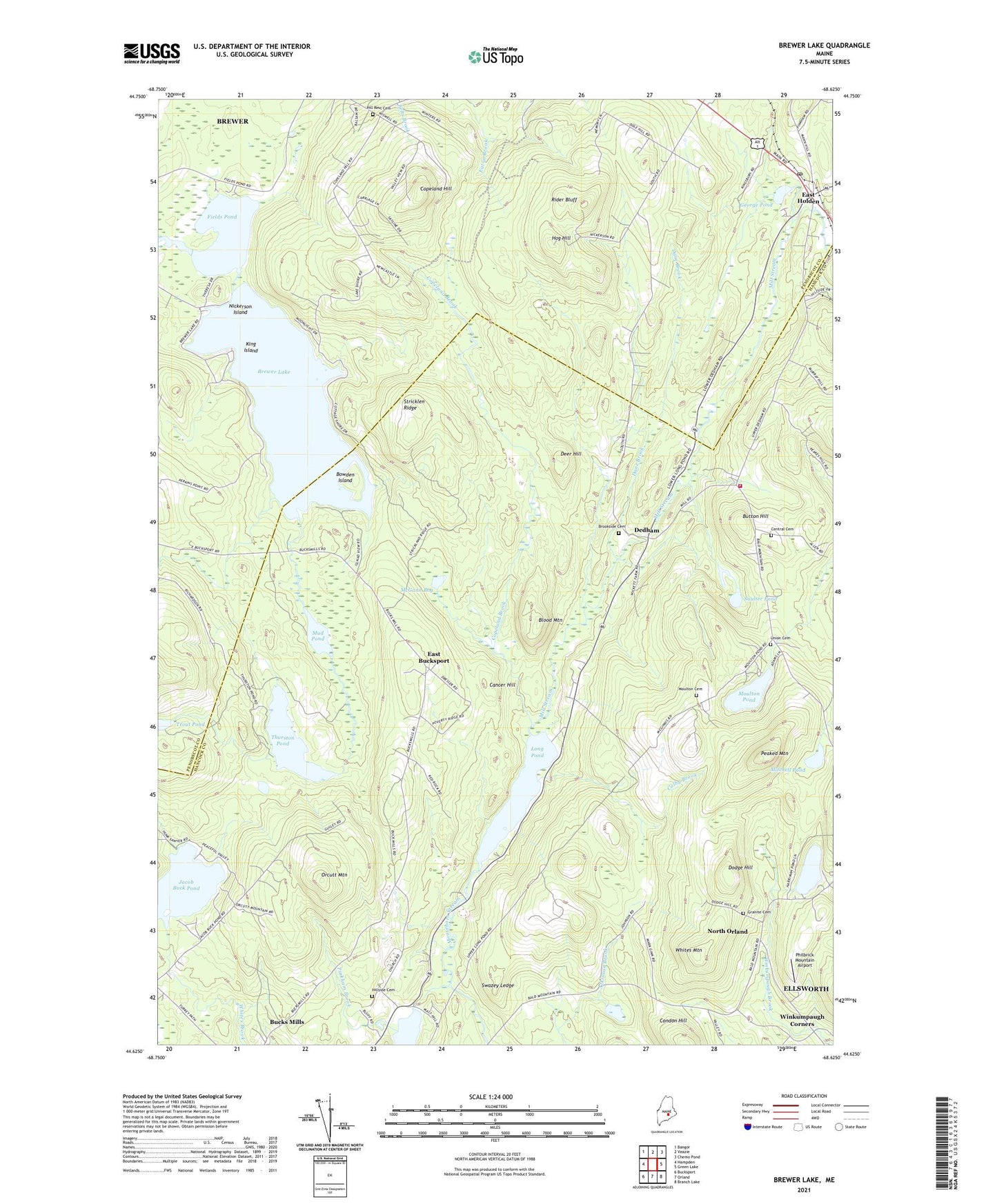
2024 topographic map quadrangle Brewer Lake in the state of Maine. Scale: 1:24000. Based on the newly updated USGS 7.5' US Topo map series, this map is in the following counties: Hancock, Penobscot. The map contains contour data, water features, and other items you are used to seeing on USGS maps, but also has updated roads and other features. This is the next generation of topographic maps. Printed on high-quality waterproof paper with UV fade-resistant inks.
Quads adjacent to this one:
West: Hampden
Northwest: Bangor
North: Veazie
Northeast: Chemo Pond
East: Green Lake
Southeast: Branch Lake
South: Orland
Southwest: Bucksport
This map covers the same area as the classic USGS quad with code o44068f6.
Contains the following named places: Blood Mountain, Bowden Island, Brewer Lake, Brewer Lake Dam, Brookside Cemetery, Bucks Mills, Button Hill, Cancer Hill, Central Cemetery, Colby Brook, Copeland Brook, Copeland Hill, Dane Brook, Dedham, Dedham Lucerne Fire Department Dedham Station, Deer Hill, Dodge Hill, East Bucksport, East Bucksport Church, East Holden, East Holden Community Church, Fields Pond, Fields Pond Settlement, George Pond, Granite Cemetery, Hancock Pond, Hanson Pond, Harriman Pond, Harts Corners, Hill Rest Cemetery, Hog Hill, Holden Post Office, Holden Station, Jacob Buck Pond, King Island, Long Pond, McGann Bog, Mill Stream, Mitchell Pond, Moulton Cemetery, Moulton Pond, Mud Pond, Nickerson Island, North Orland, Orcutt Mountain, Peaked Mountain, Philbrick Mountain Airport, Pinkham Brook, Rider Bluff, Saulter Pond, Stricklen Ridge, Swazey Ledge, Thurston Pond, Thurston Pond Dam, Town of Bucksport, Trout Pond, Union Cemetery, Whites Mountain, Winkumpaugh Corners, WLBZ-TV (Bangor)