MyTopo
Green Lake Maine US Topo Map
Couldn't load pickup availability
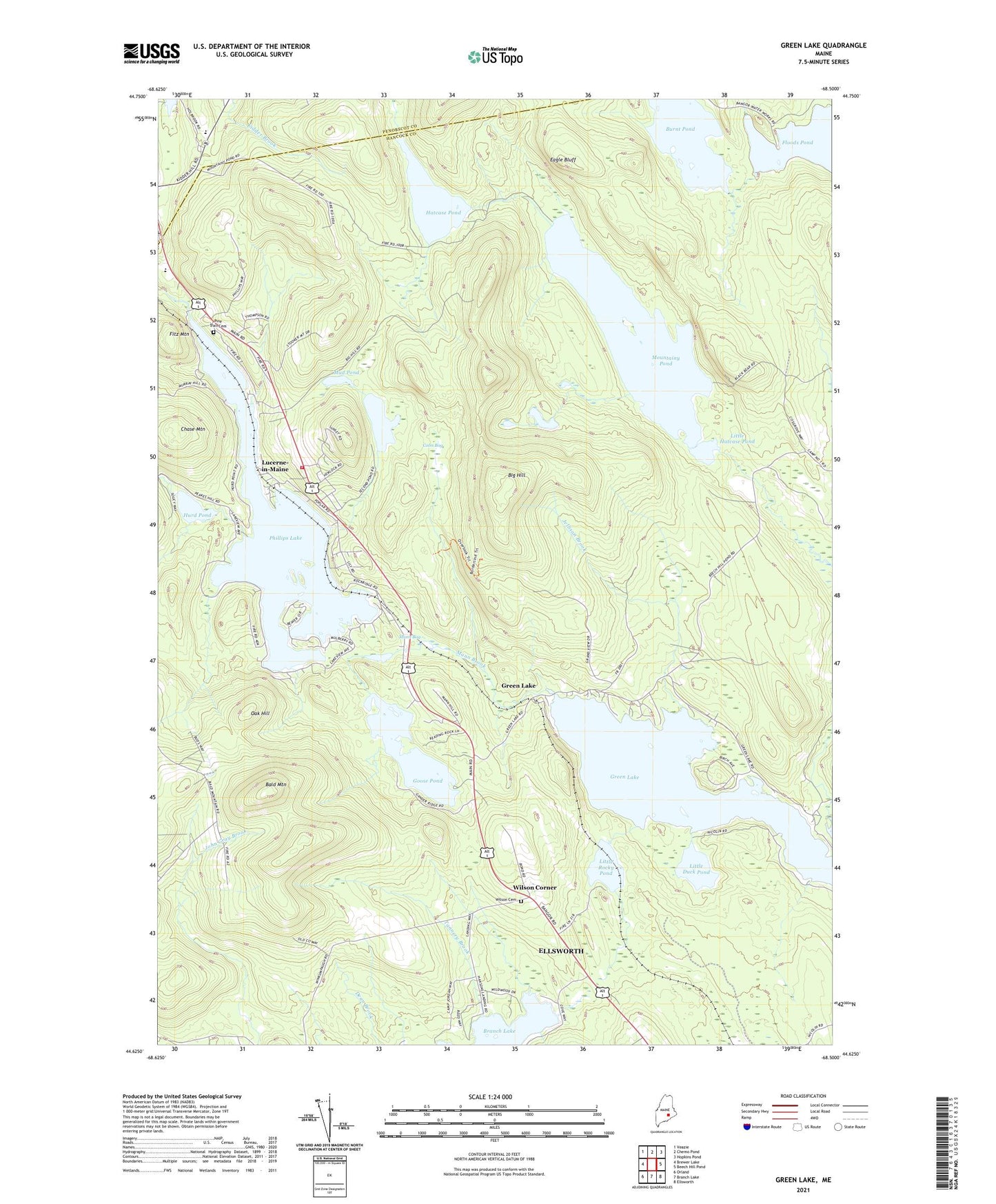
2024 topographic map quadrangle Green Lake in the state of Maine. Scale: 1:24000. Based on the newly updated USGS 7.5' US Topo map series, this map is in the following counties: Hancock, Penobscot. The map contains contour data, water features, and other items you are used to seeing on USGS maps, but also has updated roads and other features. This is the next generation of topographic maps. Printed on high-quality waterproof paper with UV fade-resistant inks.
Quads adjacent to this one:
West: Brewer Lake
Northwest: Veazie
North: Chemo Pond
Northeast: Hopkins Pond
East: Beech Hill Pond
Southeast: Ellsworth
South: Branch Lake
Southwest: Orland
This map covers the same area as the classic USGS quad with code o44068f5.
Contains the following named places: Bald Mountain, Bald Mountain Trail, Big Hill, Branch Lake Camping Area, Burnt Pond, Camp Matomba, Chase Mountain, Coon Bog, Dedham Elementary School, Dedham Lucerne Fire Department Lucerne Station, Eagle Bluff, Fitz Mountain, Goose Pond, Green Lake, Hansons Landing on Branch Lake, Hatcase Pond, Holbrook School, Hurd Pond, Jellison Brook, Little Duck Pond, Little Hatcase Pond, Little Rocky Pond, Lucerne Hills Golf Club, Lucerne-in-Maine, Mann Bog, Mann Brook, Mountainy Pond, Mud Pond, Oak Hill, Our Lady of the Lake Chapel, Phillips Lake, Phillips Lake Dam, Pine Trail Cemetery, Second Pond, Tannery Brook, Town of Dedham, Wilson Cemetery, Wilson Corner, WKSQ-FM (Ellsworth), WWMJ-FM (Ellsworth), ZIP Code: 04429