MyTopo
Mount Waldo Maine US Topo Map
Couldn't load pickup availability
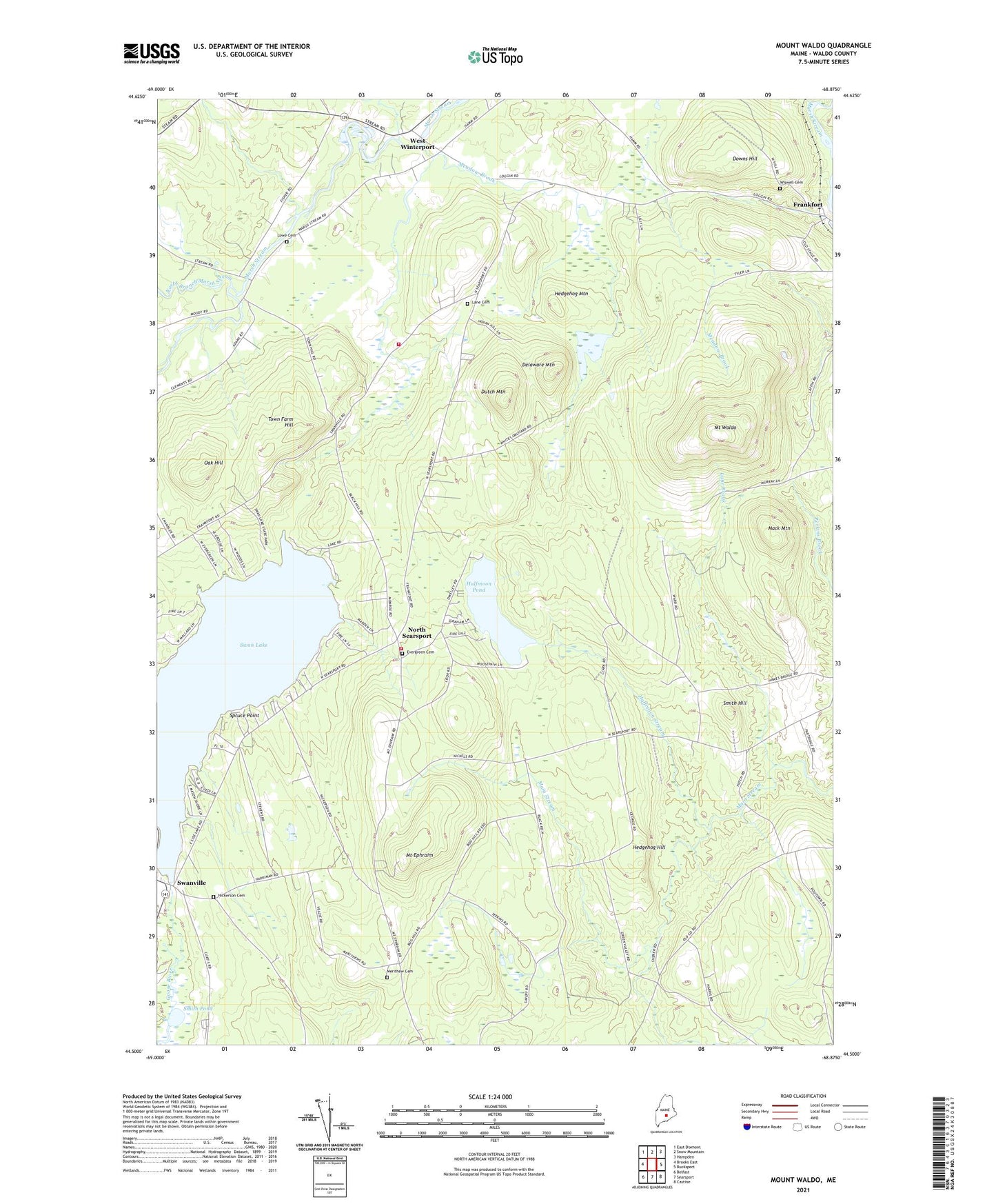
2024 topographic map quadrangle Mount Waldo in the state of Maine. Scale: 1:24000. Based on the newly updated USGS 7.5' US Topo map series, this map is in the following counties: Waldo. The map contains contour data, water features, and other items you are used to seeing on USGS maps, but also has updated roads and other features. This is the next generation of topographic maps. Printed on high-quality waterproof paper with UV fade-resistant inks.
Quads adjacent to this one:
West: Brooks East
Northwest: East Dixmont
North: Snow Mountain
Northeast: Hampden
East: Bucksport
Southeast: Castine
South: Searsport
Southwest: Belfast
This map covers the same area as the classic USGS quad with code o44068e8.
Contains the following named places: Brown Corner, Clark School, Delaware Mountain, Dodge Corner, Downs Hill, Dutch Mountain, Evergreen Cemetery, Frankfort, Frankfort Elementary School, Halfmoon Pond, Halfmoon Stream, Hedgehog Hill, Hedgehog Mountain, Lane Brook, Lane Cemetery, Lane School, Littlefield Brook, Lowe Cemetery, Mack Mountain, Main Stream, Meadow Brook, Merithew Cemetery, Mount Ephraim, Mount Waldo, Nickerson Cemetery, North Branch Marsh Stream, North Searsport, Oak Hill, Searsport North Fire Station, Smith Hill, Smith Pond, Spruce Point, Swan Lake, Swan Lake Dam, Swanville, Town Farm Hill, Town of Frankfort, WBFB-FM (Ellsworth), West Frankfort Fire Station First Responders, West Winterport, West Winterport Church, West Winterport Dam, Wiswell Cemetery, ZIP Code: 04438