MyTopo
Burnham Maine US Topo Map
Couldn't load pickup availability
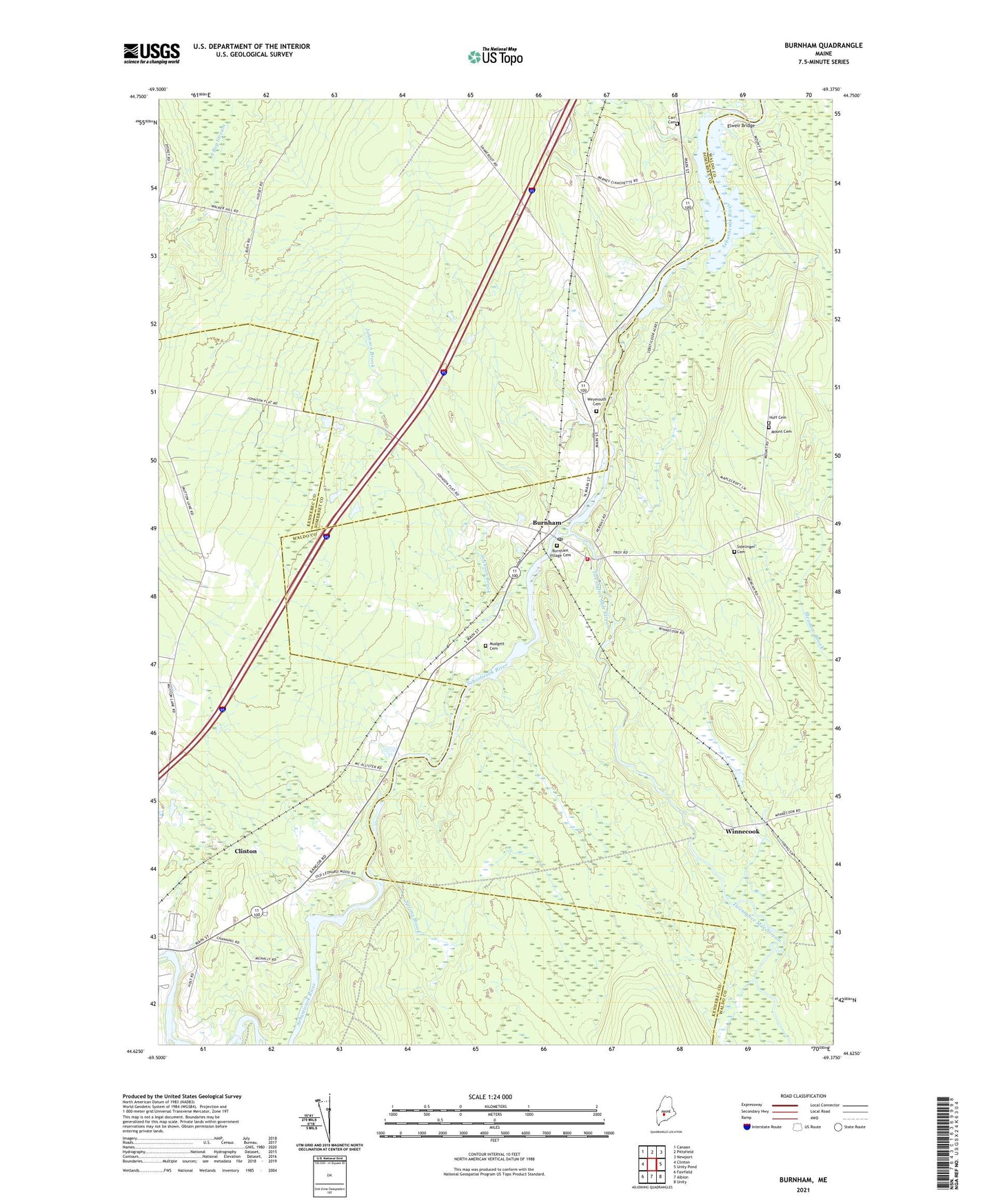
2024 topographic map quadrangle Burnham in the state of Maine. Scale: 1:24000. Based on the newly updated USGS 7.5' US Topo map series, this map is in the following counties: Waldo, Kennebec, Somerset. The map contains contour data, water features, and other items you are used to seeing on USGS maps, but also has updated roads and other features. This is the next generation of topographic maps. Printed on high-quality waterproof paper with UV fade-resistant inks.
Quads adjacent to this one:
West: Clinton
Northwest: Canaan
North: Pittsfield
Northeast: Newport
East: Unity Pond
Southeast: Unity
South: Albion
Southwest: Fairfield
This map covers the same area as the classic USGS quad with code o44069f4.
Contains the following named places: Burnham, Burnham Dam, Burnham Fire Department Station 1, Burnham Post Office, Burnham Village Cemetery, Carr Cemetery, Clinton Census Designated Place, Dixon Corner, Elweir Bridge, Johnson Brook, Mount Cemetery, Mudgett Cemetery, Nash Corner, Sebasticook River Reservoir, Spring Brook, Town of Burnham, Township of Unity, Twentyfive Mile Stream, Weymouth Cemetery, Winnecook, ZIP Code: 04922