MyTopo
Cambridge Maine US Topo Map
Couldn't load pickup availability
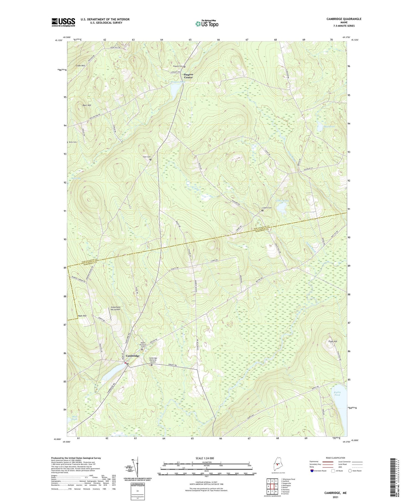
2021 topographic map quadrangle Cambridge in the state of Maine. Scale: 1:24000. Based on the newly updated USGS 7.5' US Topo map series, this map is in the following counties: Piscataquis, Somerset. The map contains contour data, water features, and other items you are used to seeing on USGS maps, but also has updated roads and other features. This is the next generation of topographic maps. Printed on high-quality waterproof paper with UV fade-resistant inks.
Quads adjacent to this one:
West: Wellington
Northwest: Whetstone Pond
North: Guilford
Northeast: Sangerville
East: Dexter
Southeast: Corinna
South: Hartland
Southwest: Harmony
Contains the following named places: Austin Brook, Cambridge, Cambridge Elementary School, Cambridge Fire Department, Cambridge Flats School, Cambridge Memorial Garden, Cambridge Pond, Cambridge Pond Dam, Cambridge Post Office, Dorr Hill, Dorr Hill School, Ferguson Brook, Ferguson Stream, Fush Hill, Gilbert Cemetery, Gilbert Pond, Greenfield Hill Airport, Ham Hill, Head of Pond School, Ike Brook, Jimmy Brook, Main Stream Sebasticook River, Manter School, Mount Pleasant Cemetery, Mud Pond, Packard Brook, Page Brook, Pingree Cemetery, Pingree Center, Pingree Dam, Pingree Pond, Ripley Pond, Smart School, Southworth School, Town of Cambridge, Town of Parkman, Town of Ripley, Tyler Cemetery, Webber School, ZIP Code: 04923