MyTopo
Harmony Maine US Topo Map
Couldn't load pickup availability
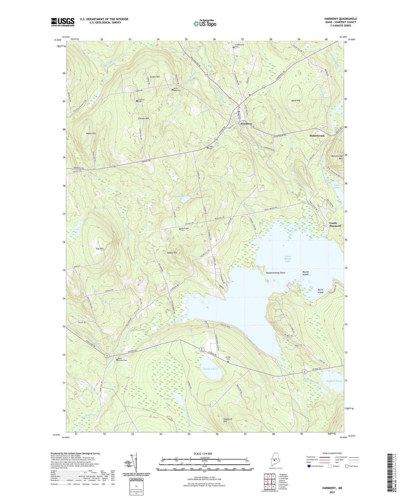
2024 topographic map quadrangle Harmony in the state of Maine. Scale: 1:24000. Based on the newly updated USGS 7.5' US Topo map series, this map is in the following counties: Somerset. The map contains contour data, water features, and other items you are used to seeing on USGS maps, but also has updated roads and other features. This is the next generation of topographic maps. Printed on high-quality waterproof paper with UV fade-resistant inks.
Quads adjacent to this one:
West: Athens
Northwest: Kingsbury
North: Wellington
Northeast: Cambridge
East: Hartland
Southeast: Pittsfield
South: Canaan
Southwest: Skowhegan
This map covers the same area as the classic USGS quad with code o44069h5.
Contains the following named places: Birch Island, Black Stream, Bog Pond, Brown Brook, Carson Hill, Castle Harmony, Chadbourne Cemetery, Church Brook, Corson Corner, Fox Hill, Grant Brook, Grant Hill, Great Moose Lake, Halfway Point, Harmony, Harmony Elementary School, Harmony Fire Department, Harmony Post Office, Harmony Regional Ambulance Service, Higgins Brook, Higgins Brook Dam, Higgins Stream, Hurd Hill, Joaquin Brook, Jordan Cemetery, Kimball Brook, Lake Como, Ledge Island, Leighton Cemetery, Lemon Stream, Libby Cemetery, Little Ferguson Brook, Magoon Brook, Mainstream, Mainstream Station, Mud Pond, North Road Cemetery, Passaconaway Point, Peeks Hill, Perry Pond, Round Island, Stafford Hill, Stafford Pond, Starbird Pond, Talbot Hill, The Narrows, Town of Harmony, Town of Hartland, Tuttle Brook, Whitehouse Brook, Withee Brook, ZIP Code: 04943