MyTopo
Caratunk Maine US Topo Map
Couldn't load pickup availability
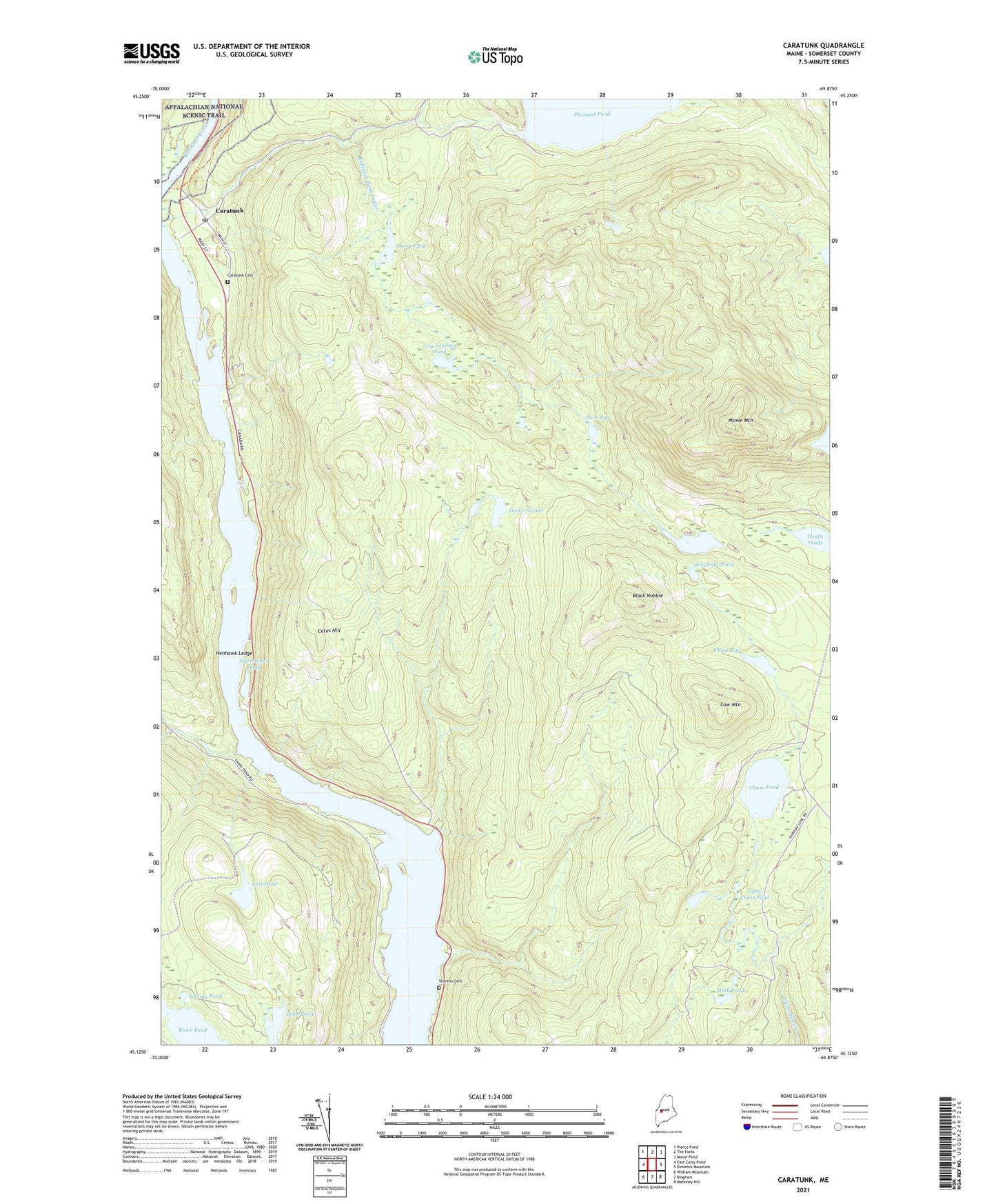
2021 topographic map quadrangle Caratunk in the state of Maine. Scale: 1:24000. Based on the newly updated USGS 7.5' US Topo map series, this map is in the following counties: Somerset. The map contains contour data, water features, and other items you are used to seeing on USGS maps, but also has updated roads and other features. This is the next generation of topographic maps. Printed on high-quality waterproof paper with UV fade-resistant inks.
Quads adjacent to this one:
West: East Carry Pond
Northwest: Pierce Pond
North: The Forks
Northeast: Moxie Pond
East: Dimmick Mountain
Southeast: Mahoney Hill
South: Bingham
Southwest: Witham Mountain
Contains the following named places: Bean Pond, Black Nubble, Brandy Pond, Caratunk, Caratunk Cemetery, Caratunk Post Office, Carney Brook, Carrying Place Stream, Cates Hill, Chase Bog, Chase Pond, Cow Mountain, Decker Brook, Decker Ponds, Deer Bog, Doughnut Pond, Heald Ponds, Henhawk Ledge, Little Chase Pond, Log Landing Pond, Lost Pond, Macdougall Pond, Mink Ponds, Moores Bog, Moxie Mountain, Pleasant Pond Dam, Pleasant Pond Stream, Robinson Pond, Robinson Pond Outler, Stevens Cemetery, Sunday Pond, Town of Caratunk, ZIP Code: 04925