MyTopo
The Forks Maine US Topo Map
Couldn't load pickup availability
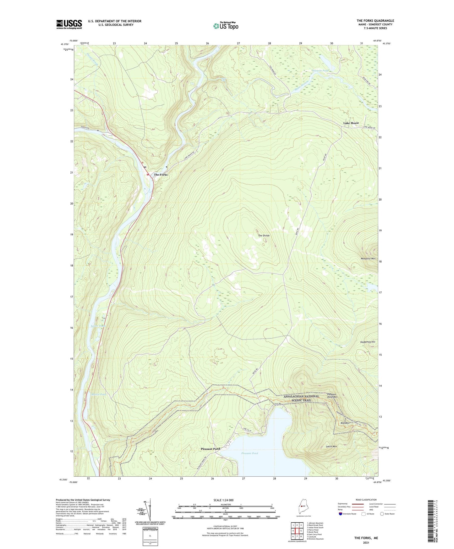
2024 topographic map quadrangle The Forks in the state of Maine. Scale: 1:24000. Based on the newly updated USGS 7.5' US Topo map series, this map is in the following counties: Somerset. The map contains contour data, water features, and other items you are used to seeing on USGS maps, but also has updated roads and other features. This is the next generation of topographic maps. Printed on high-quality waterproof paper with UV fade-resistant inks.
Quads adjacent to this one:
West: Pierce Pond
Northwest: Johnson Mountain
North: Black Brook Pond
Northeast: Indian Pond South
East: Moxie Pond
Southeast: Dimmick Mountain
South: Caratunk
Southwest: East Carry Pond
This map covers the same area as the classic USGS quad with code o45069c8.
Contains the following named places: Ball School, Cold Stream, Dead River, Durgin Brook, Franklin School, Gilroy Brook, Holly Brook, Kelly Brook, Lake Moxie, Martin Pond, Middle Mountain, Mile Brook, Mink Brook, Moxie Falls, Moxie Stream, Northern Outdoors Campground, Plantation of The Forks, Pleasant Pond, Pleasant Pond Mountain, Pooler Ponds, Prescott Pond, South Mountain, The Divide, The Forks, West Fork Fire Department, West Forks Post Office, ZIP Code: 04985