MyTopo
Pierce Pond Maine US Topo Map
Couldn't load pickup availability
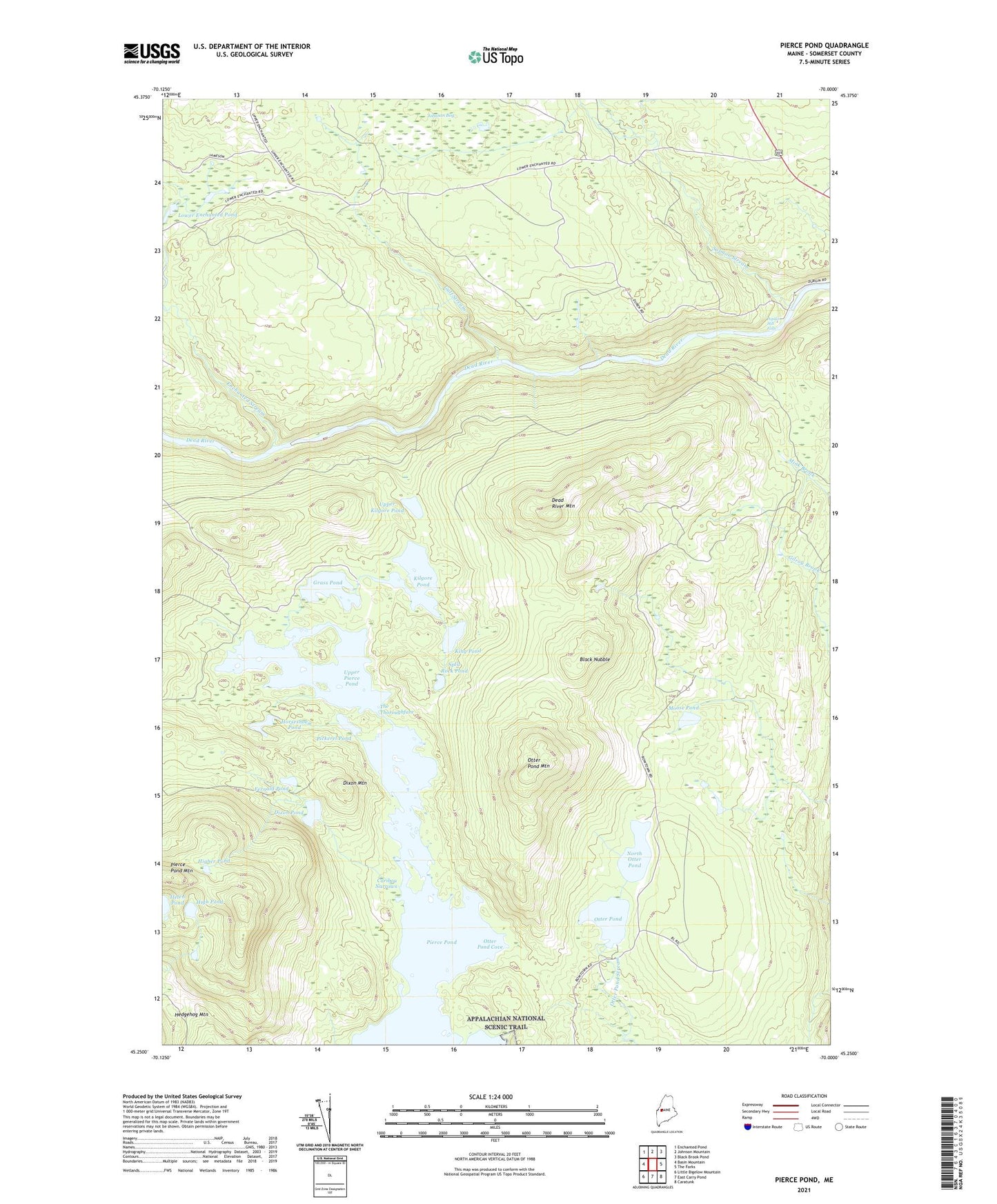
2024 topographic map quadrangle Pierce Pond in the state of Maine. Scale: 1:24000. Based on the newly updated USGS 7.5' US Topo map series, this map is in the following counties: Somerset. The map contains contour data, water features, and other items you are used to seeing on USGS maps, but also has updated roads and other features. This is the next generation of topographic maps. Printed on high-quality waterproof paper with UV fade-resistant inks.
Quads adjacent to this one:
West: Basin Mountain
Northwest: Enchanted Pond
North: Johnson Mountain
Northeast: Black Brook Pond
East: The Forks
Southeast: Caratunk
South: East Carry Pond
Southwest: Little Bigelow Mountain
This map covers the same area as the classic USGS quad with code o45070c1.
Contains the following named places: Appletree Inn, Black Nubble, Bowtown Township, Caribou Narrows, Comber Inn, Dead River Mountain, Dixon Mountain, Dixon Pond, Enchanted Stream, Fernald Pond, Grass Pond, Gulf Stream, High Pond, Higher Pond, Horseshoe Pond, Johnson Bog, Kilgore Pond, King Pond, Lindsay Cove, Lower Enchanted Pond, Moose Pond, North Otter Pond, Otter Pond, Otter Pond Camps, Otter Pond Cove, Otter Pond Mountain, Pickerel Pond, Pierce Pond, Pierce Pond Camps, Pierce Pond Mountain, Poplar Hill Falls, Salmon Stream, Split Rock Pond, The Thoroughfare, Upper Kilgore Pond, Upper Pierce Pond