MyTopo
Moxie Pond Maine US Topo Map
Couldn't load pickup availability
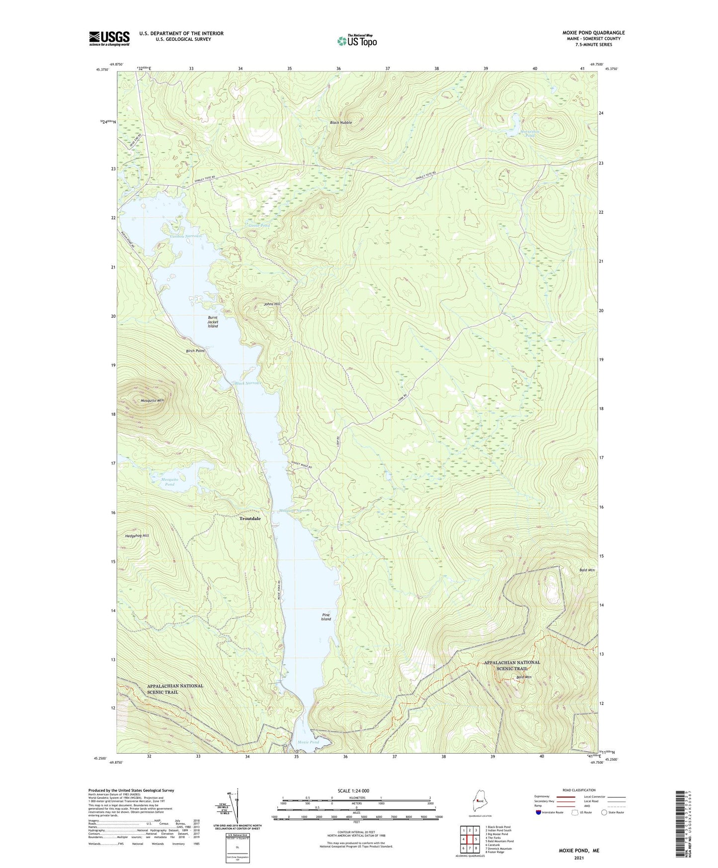
2024 topographic map quadrangle Moxie Pond in the state of Maine. Scale: 1:24000. Based on the newly updated USGS 7.5' US Topo map series, this map is in the following counties: Somerset. The map contains contour data, water features, and other items you are used to seeing on USGS maps, but also has updated roads and other features. This is the next generation of topographic maps. Printed on high-quality waterproof paper with UV fade-resistant inks.
Quads adjacent to this one:
West: The Forks
Northwest: Black Brook Pond
North: Indian Pond South
Northeast: Big Moose Pond
East: Bald Mountain Pond
Southeast: Foster Ridge
South: Dimmick Mountain
Southwest: Caratunk
This map covers the same area as the classic USGS quad with code o45069c7.
Contains the following named places: Bald Mountain, Bald Mountain Brook, Bear Brook, Big Sandy Stream, Birch Point, Black Narrows, Black Nubble, Burnt Jacket Island, Caribou Narrows, East Moxie Township, Goose Pond, Hedgehog Hill, Horseshoe Pond, Joes Hole, Johns Hill, Little Sandy Stream, Mosquito Mountain, Mosquito Narrows, Mosquito Pond, Mosquito Stream, Moxie Pond, Moxie Pond Dam, Pine Island, Troutdale