MyTopo
Carr Pond Maine US Topo Map
Couldn't load pickup availability
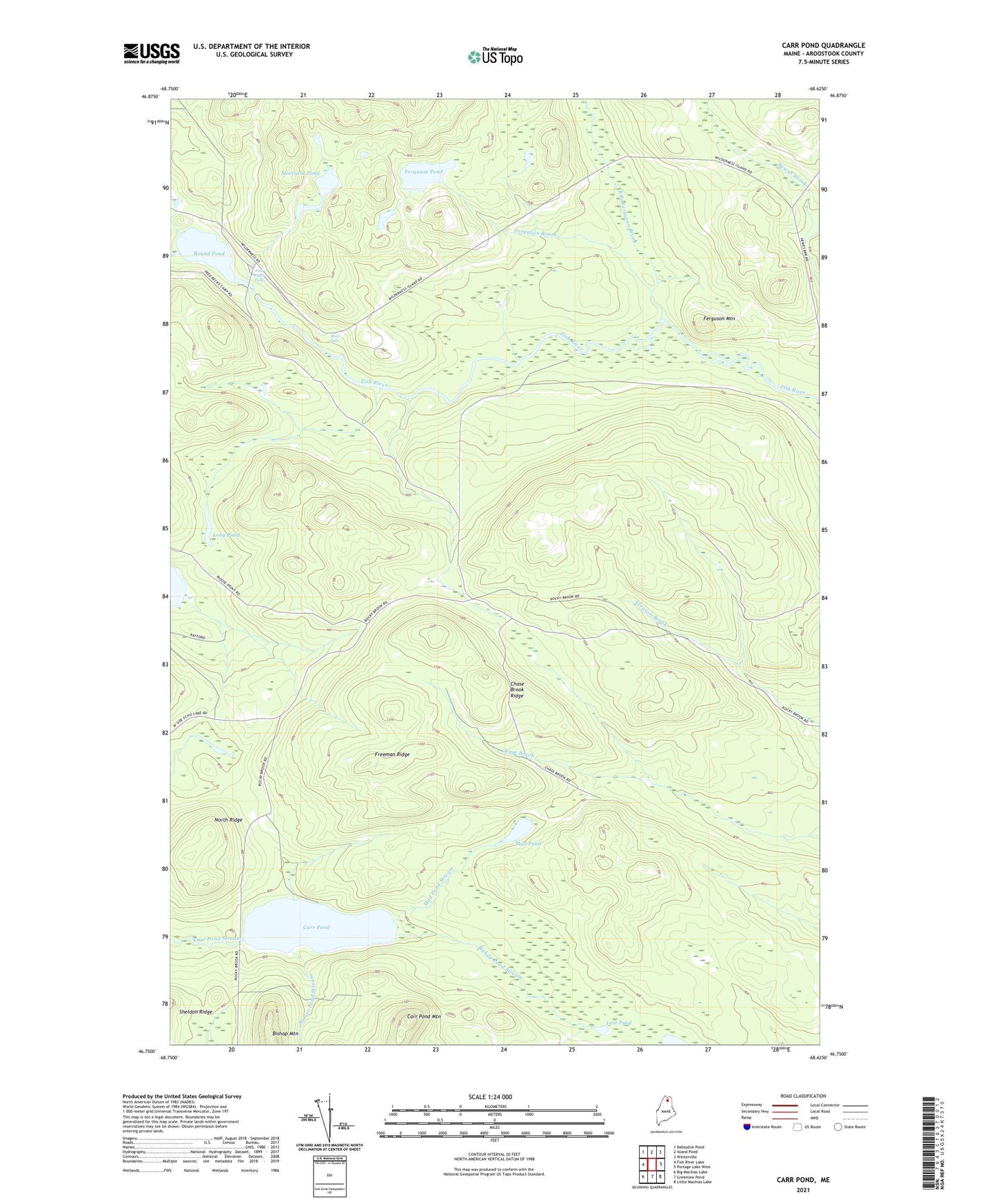
2024 topographic map quadrangle Carr Pond in the state of Maine. Scale: 1:24000. Based on the newly updated USGS 7.5' US Topo map series, this map is in the following counties: Aroostook. The map contains contour data, water features, and other items you are used to seeing on USGS maps, but also has updated roads and other features. This is the next generation of topographic maps. Printed on high-quality waterproof paper with UV fade-resistant inks.
Quads adjacent to this one:
West: Fish River Lake
Northwest: Deboullie Pond
North: Island Pond
Northeast: Winterville
East: Portage Lake West
Southeast: Little Machias Lake
South: Greenlaw Pond
Southwest: Big Machias Lake
This map covers the same area as the classic USGS quad with code o46068g6.
Contains the following named places: Bishop Mountain, Bishop Pond Stream, Carr Pond, Carr Pond Mountain, Chase Brook Ridge, East Branch Ferguson Brook, Ferguson Brook, Ferguson Mountain, Ferguson Pond, Fish River Falls, Freeman Ridge, High Landing, Long Pond, Lost Pond, Moccasin Pond, Moose Pond Stream, Mud Pond, Mud Pond Stream, North Ridge, Round Pond, Skew Falls, T13 R7 WELS