MyTopo
Deboullie Pond Maine US Topo Map
Couldn't load pickup availability
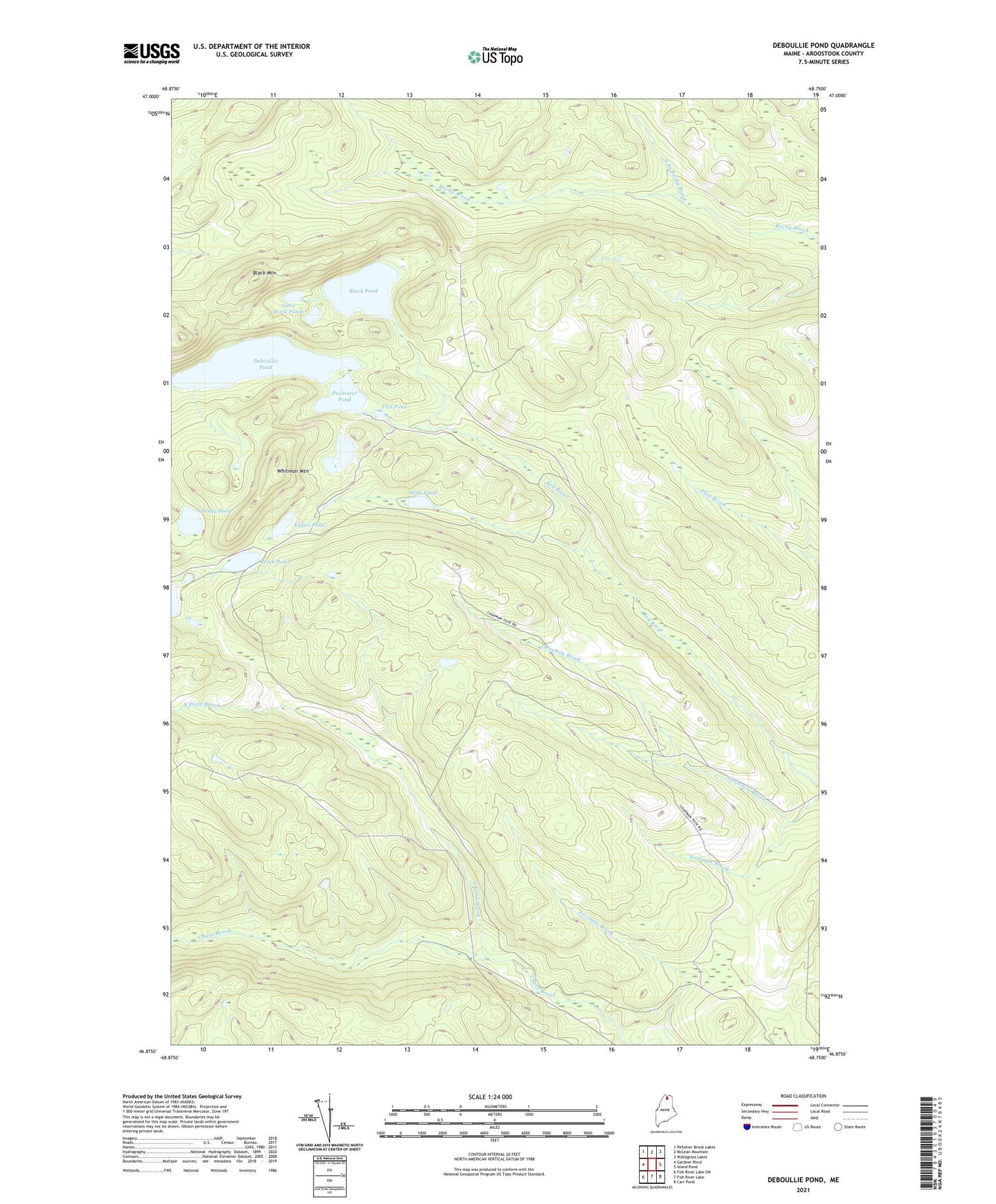
2024 topographic map quadrangle Deboullie Pond in the state of Maine. Scale: 1:24000. Based on the newly updated USGS 7.5' US Topo map series, this map is in the following counties: Aroostook. The map contains contour data, water features, and other items you are used to seeing on USGS maps, but also has updated roads and other features. This is the next generation of topographic maps. Printed on high-quality waterproof paper with UV fade-resistant inks.
Quads adjacent to this one:
West: Gardner Pond
Northwest: Pelletier Brook Lakes
North: McLean Mountain
Northeast: Wallagrass Lakes
East: Island Pond
Southeast: Carr Pond
South: Fish River Lake
Southwest: Fish River Lake SW
This map covers the same area as the classic USGS quad with code o46068h7.
Contains the following named places: Black Mountain, Black Pond, Deboullie Pond, Denny Pond, Fish Pond, Island Pond, Little Black Ponds, Michauds Mill, North Branch Rocky Brook, North Pond Brook, Perch Pond, Perch Pond Dam, Pushineer Pond, Red River Camps, Stink Pond, T14 R8 WELS, T15 R8 WELS, Threemile Brook, Upper Pond, Whitman Mountain