MyTopo
Chain of Ponds Maine US Topo Map
Couldn't load pickup availability
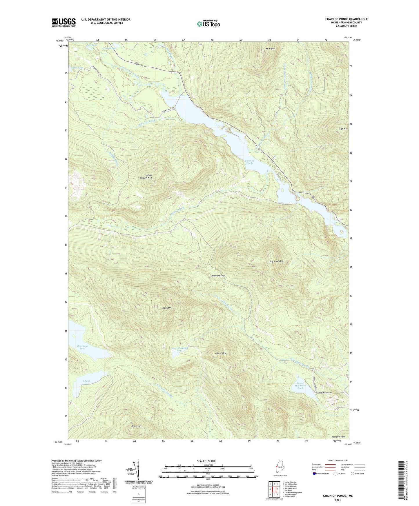
2021 topographic map quadrangle Chain of Ponds in the state of Maine. Scale: 1:24000. Based on the newly updated USGS 7.5' US Topo map series, this map is in the following counties: Franklin. The map contains contour data, water features, and other items you are used to seeing on USGS maps, but also has updated roads and other features. This is the next generation of topographic maps. Printed on high-quality waterproof paper with UV fade-resistant inks.
Quads adjacent to this one:
West: Northwest Pond
Northwest: Louise Mountain
North: Merrill Mountain
Northeast: Kibby Mountain
East: Jim Pond
Southeast: Tim Mountain
South: Black Mountain
Southwest: Little Kennebago Lake
Contains the following named places: Alder Stream Township, Arnold Pond Trail, Bag Pond, Bag Pond Mountain, Bear Brook, Big Island Camp, Big Island Pond, Caribou Bog, Chain Lakes, Chain Lakes Dam, Chain of Ponds, Chain of Ponds Camp, Chain of Ponds Township, Clearwater Brook, Delaware Gap, Halfmile Brook, Horseshoe Stream, Indian Stream, Indian Stream Mountain, L Pond, Long Pond, Lost Pond, Lower Pond, Morrell Trail, Mount Pisgah, Natanis Pond, Onion Hill, Robinson Brook, Round Mountain, Round Mountain Pond, Round Pond, Sisk Mountain, Snow Mountain, Snow Mountain Pond, Unorganized Territory of North Franklin, Upper Farm, West Branch Clearwater Brook