MyTopo
Third Musquacook Lake Maine US Topo Map
Couldn't load pickup availability
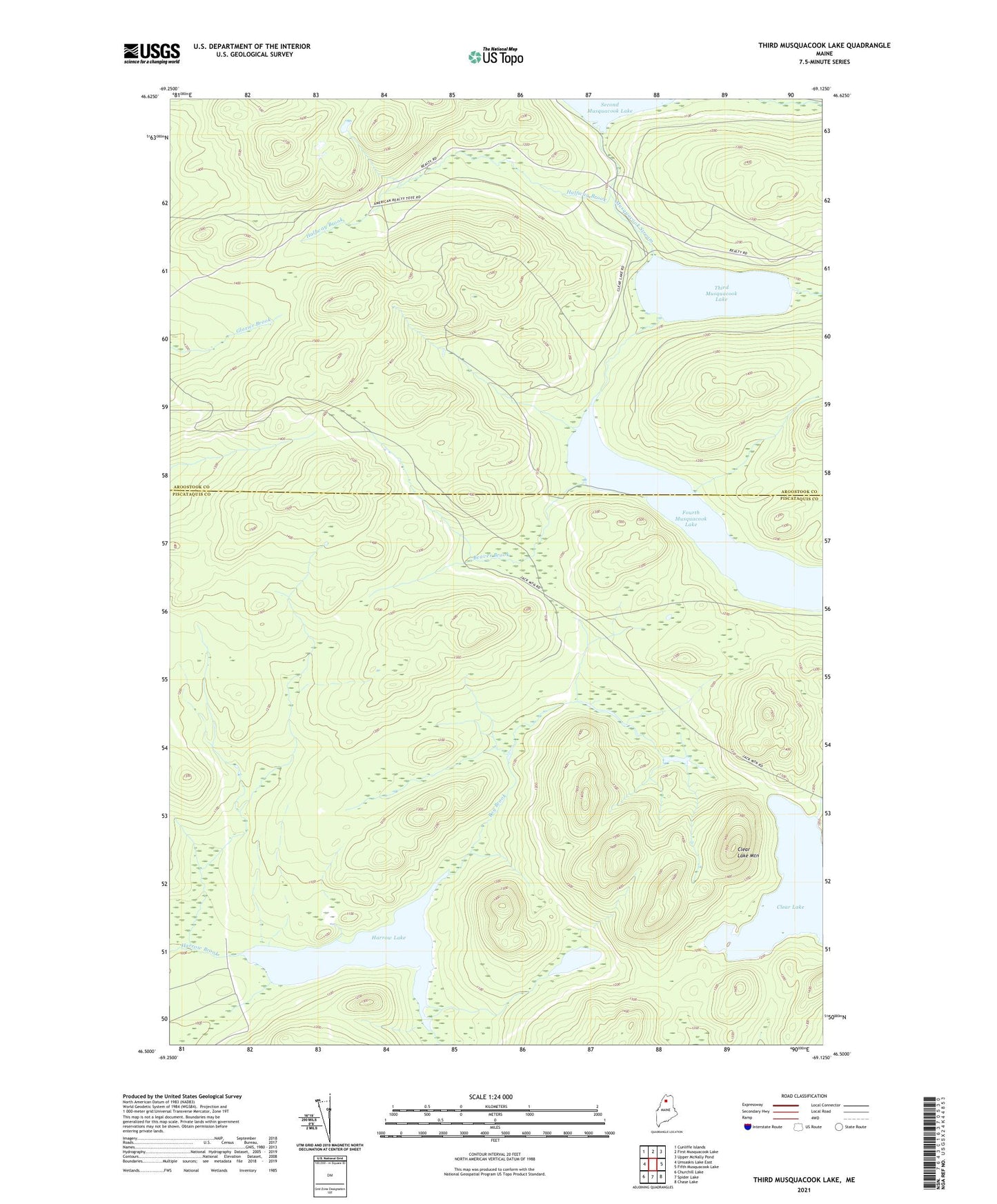
2024 topographic map quadrangle Third Musquacook Lake in the state of Maine. Scale: 1:24000. Based on the newly updated USGS 7.5' US Topo map series, this map is in the following counties: Piscataquis, Aroostook. The map contains contour data, water features, and other items you are used to seeing on USGS maps, but also has updated roads and other features. This is the next generation of topographic maps. Printed on high-quality waterproof paper with UV fade-resistant inks.
Quads adjacent to this one:
West: Umsaskis Lake East
Northwest: Cunliffe Islands
North: First Musquacook Lake
Northeast: Upper McNally Pond
East: Fifth Musquacook Lake
Southeast: Chase Lake
South: Spider Lake
Southwest: Churchill Lake
This map covers the same area as the classic USGS quad with code o46069e2.
Contains the following named places: Beaver Brook, Bog Brook, Clear Lake, Clear Lake Mountain, Fourth Musquacook Lake, Halfway Brook, Harrow Lake, Little Harrow Lake, T10 R11 WELS, T11 R11 WELS, Third Musquacook Lake