MyTopo
Haymock Lake Maine US Topo Map
Couldn't load pickup availability
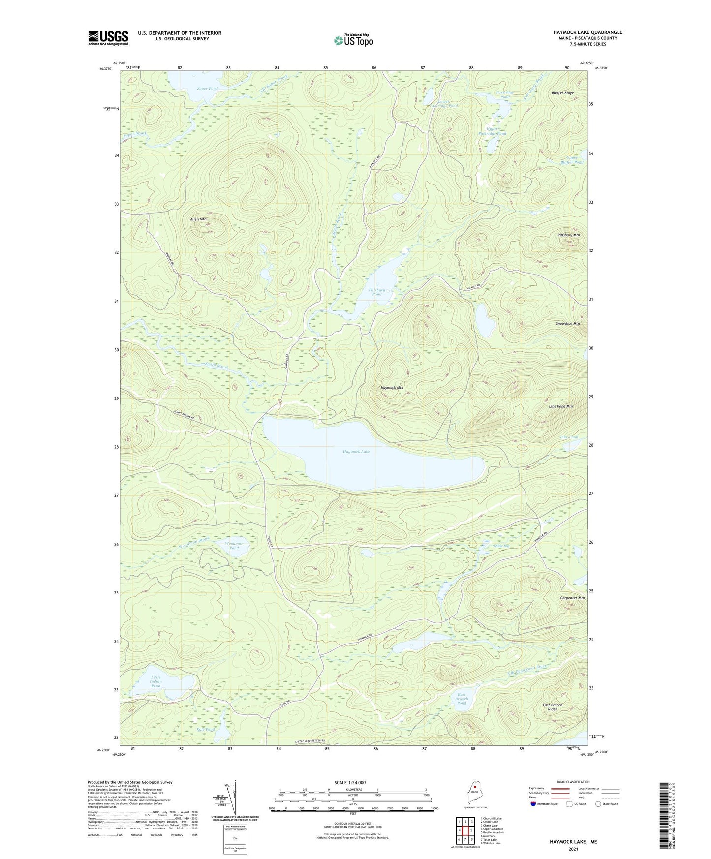
2024 topographic map quadrangle Haymock Lake in the state of Maine. Scale: 1:24000. Based on the newly updated USGS 7.5' US Topo map series, this map is in the following counties: Piscataquis. The map contains contour data, water features, and other items you are used to seeing on USGS maps, but also has updated roads and other features. This is the next generation of topographic maps. Printed on high-quality waterproof paper with UV fade-resistant inks.
Quads adjacent to this one:
West: Soper Mountain
Northwest: Churchill Lake
North: Spider Lake
Northeast: Chase Lake
East: Beetle Mountain
Southeast: Webster Lake
South: Telos Lake
Southwest: Mud Pond
This map covers the same area as the classic USGS quad with code o46069c2.
Contains the following named places: Allen Mountain, Bluffer Ridge, Carpenter Mountain, East Branch Pond, East Branch Ridge, Fourth Lake, Haymock Lake, Haymock Mountain, Kyle Pond, Line Pond, Line Pond Mountain, Little Indian Pond, Little Pillsbury Pond, Lower Partridge Pond, North Branch Soper Brook, Partridge Pond, Pillsbury Mountain, Pillsbury Pond, Snake Bog, Soper Pond, South Branch Soper Brook, Stink Pond, T7 R11 WELS, T8 R11 WELS, Upper Partridge Pond, Woodman Pond