MyTopo
Ebeemee Mountain Maine US Topo Map
Couldn't load pickup availability
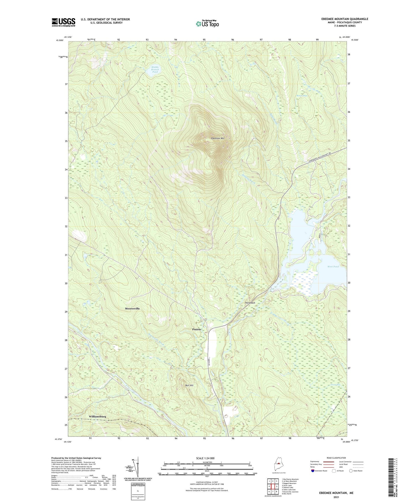
2021 topographic map quadrangle Ebeemee Mountain in the state of Maine. Scale: 1:24000. Based on the newly updated USGS 7.5' US Topo map series, this map is in the following counties: Piscataquis. The map contains contour data, water features, and other items you are used to seeing on USGS maps, but also has updated roads and other features. This is the next generation of topographic maps. Printed on high-quality waterproof paper with UV fade-resistant inks.
Quads adjacent to this one:
West: Silver Lake
Northwest: Big Shanty Mountain
North: Jo-Mary Mountain
Northeast: Ragged Mountain
East: Seboeis Lake
Southeast: Milo North
South: Brownville Junction
Southwest: Sebec Lake East
Contains the following named places: Ashworth Brook, Babel Brook, Beaver Bogs, Black Brook, Bog Brook, Bull Hill, Ebeemee Lake, Ebeemee Mountain, Ebeemee Township, Homes Brook, Horseback, Horseshoe Pond, Hungry Brook, Juniper Swamp Brook, Lower Ebeemee Pond, Middle Branch Pleasant River, Middle Branch Pond, Mooresville, Mooresville Brook, Number Two Trail, Orson Bog, Orson Brook, Pearl Pond, Prairie, Roaring Brook, Stinking Brook, Strout Camp, West Pond, Williamsburg, ZIP Codes: 04414, 04415