MyTopo
Milo North Maine US Topo Map
Couldn't load pickup availability
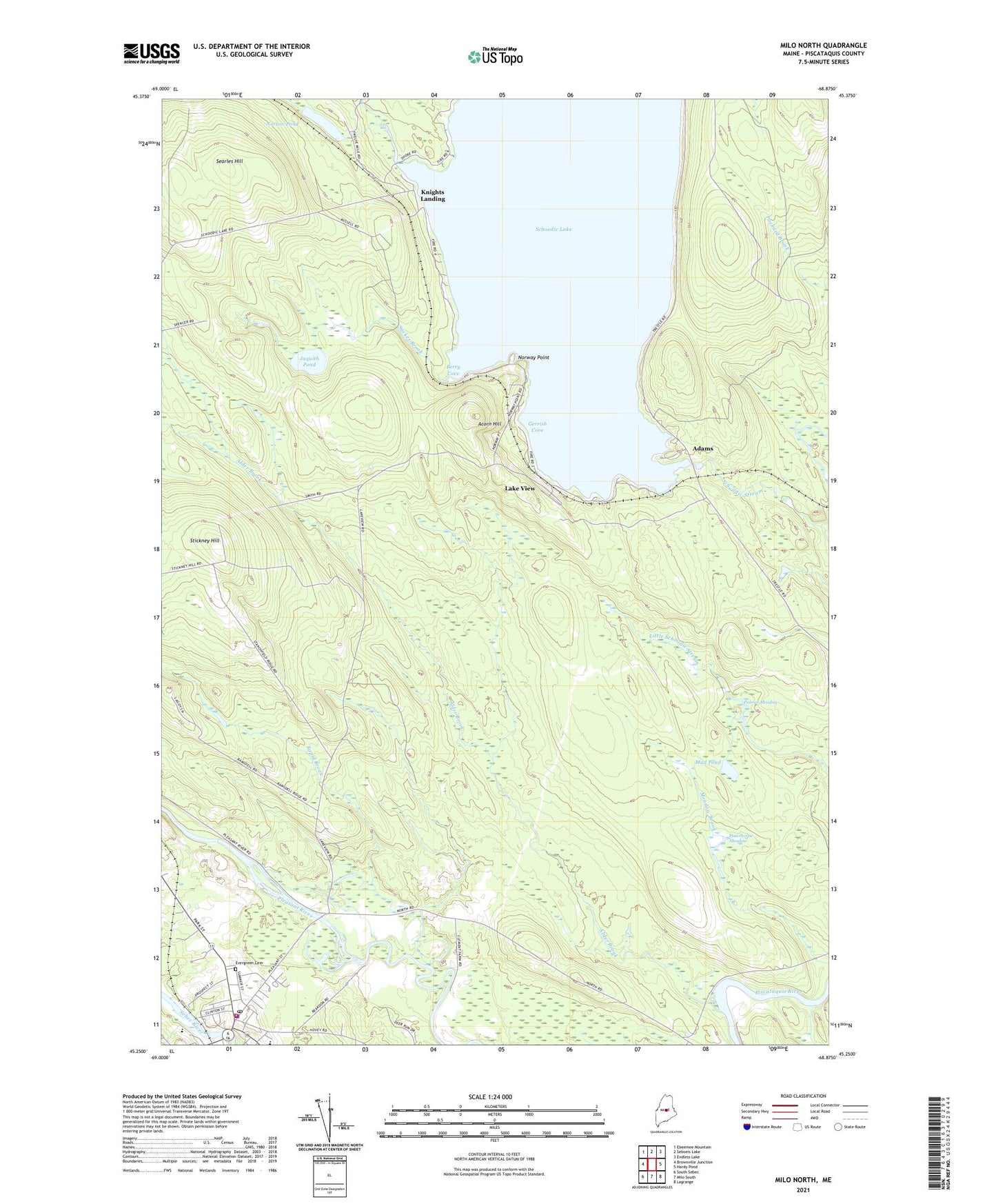
2024 topographic map quadrangle Milo North in the state of Maine. Scale: 1:24000. Based on the newly updated USGS 7.5' US Topo map series, this map is in the following counties: Piscataquis. The map contains contour data, water features, and other items you are used to seeing on USGS maps, but also has updated roads and other features. This is the next generation of topographic maps. Printed on high-quality waterproof paper with UV fade-resistant inks.
Quads adjacent to this one:
West: Brownville Junction
Northwest: Ebeemee Mountain
North: Seboeis Lake
Northeast: Endless Lake
East: Hardy Pond
Southeast: Lagrange
South: Milo South
Southwest: South Sebec
This map covers the same area as the classic USGS quad with code o45068c8.
Contains the following named places: Acorn Hill, Adams, Alder Brook, Berry Cove, Evergreen Cemetery, Gerrish Cove, Hawthorne Meadow, Jaquith Pond, Katahdin Country Club, Knights Landing, Lake View, Milo, Milo Dam, Milo Elementary School, Milo Fire Station, Milo Free Public Library, Milo Police Department, Milo Post Office, Mud Pond, Norton Pond, Norway Point, Palmer Meadow, Penquis Valley Middle / High School, Penquis Valley Middle School, Rapid Brook, Schoodic Lake, Schoodic Lake Dam, Searles Hill, Sebec River Reservoir, Stickney Hill, Sucker Brook, Three Rivers Ambulance Service, Town of Milo, ZIP Code: 04463