MyTopo
Fort Fairfield Maine US Topo Map
Couldn't load pickup availability
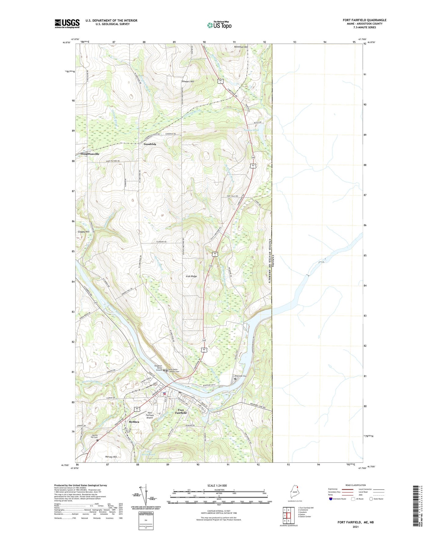
2024 topographic map quadrangle Fort Fairfield in the state of Maine. Scale: 1:24000. Based on the newly updated USGS 7.5' US Topo map series, this map is in the following counties: Aroostook. The map contains contour data, water features, and other items you are used to seeing on USGS maps, but also has updated roads and other features. This is the next generation of topographic maps. Printed on high-quality waterproof paper with UV fade-resistant inks.
Quads adjacent to this one:
West: Goodwin
Northwest: Fort Fairfield NW
North: Limestone
South: Easton Center
Southwest: Easton
This map covers the same area as the classic USGS quad with code o46067g7.
Contains the following named places: Amsden Brook, Bethel Baptist Church, Coloney Brook, Dirigere Christian Academy Fort Fairfield, East Road, Everett Brook, Fort Fairfield, Fort Fairfield Airport, Fort Fairfield Census Designated Place, Fort Fairfield Elementary School, Fort Fairfield Fire Department, Fort Fairfield High School, Fort Fairfield Middle / High School, Fort Fairfield Municipal Building, Fort Fairfield Police Department, Fort Fairfield Post Office, Fort Fairfield Public Library, Frontier Heritage History Museum, Giggey Hill, Goodrich, Goodrich Brook, Hacker Brook, Harvey Hill, Harvey Hill Cemetery, Hockenhull Brook, Houghton Burial Ground, Houghtonville, Irish Ridge, Libby Brook, Libby Brook Dam, Libby Brook Pond, McDonald Brook, McShea, Morrow Road, Nadeau Pond, Pattee Brook, Proposed New Mill Dam, Riverside Cemetery, Saint Denis Catholic Cemetery, Saint Denis Church, Saint Paul Church, Stevensville, Stewart Hill, The Aroostook Medical Center Fort Fairfield Health Center, Town of Fort Fairfield, United Parish Church, United Pentecostal Church, Village Square Shopping Center, Webster Brook, Wesleyan Church, ZIP Code: 04742