MyTopo
Goodwin Maine US Topo Map
Couldn't load pickup availability
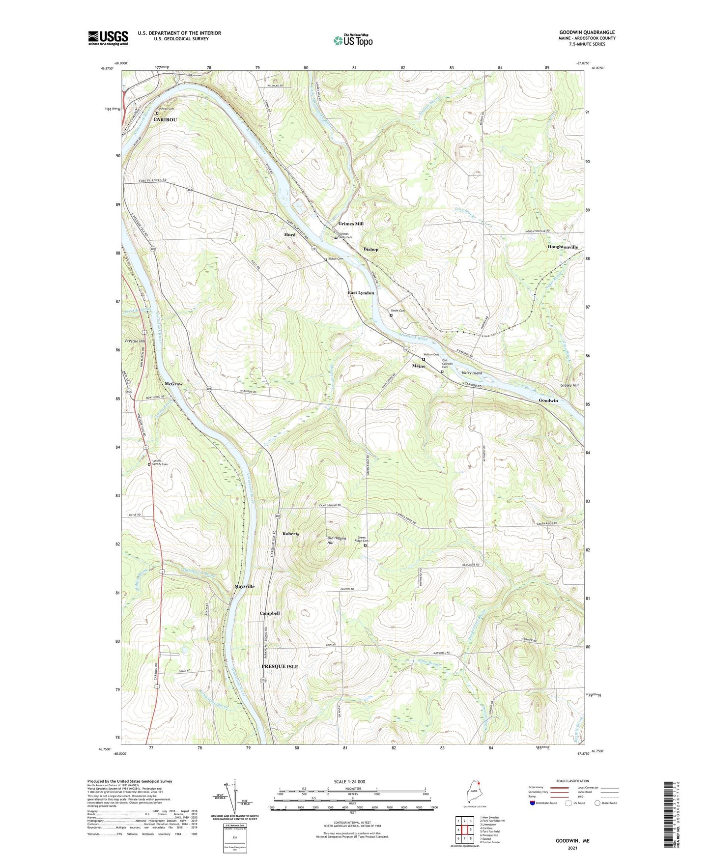
2024 topographic map quadrangle Goodwin in the state of Maine. Scale: 1:24000. Based on the newly updated USGS 7.5' US Topo map series, this map is in the following counties: Aroostook. The map contains contour data, water features, and other items you are used to seeing on USGS maps, but also has updated roads and other features. This is the next generation of topographic maps. Printed on high-quality waterproof paper with UV fade-resistant inks.
Quads adjacent to this one:
West: Caribou
Northwest: New Sweden
North: Fort Fairfield NW
Northeast: Limestone
East: Fort Fairfield
Southeast: Easton Center
South: Easton
Southwest: Presque Isle
This map covers the same area as the classic USGS quad with code o46067g8.
Contains the following named places: Birch Brook, Bishop, Bubar Cemetery, Campbell, Circle of Learning School, City of Caribou, Cochran Cemetery, Conant Brook, Dow, Doyle Cemetery, East Lyndon, Ginn Brook, Glidden Brook, Goodwin, Gray Brook, Green Ridge, Green Ridge Cemetery, Grimes Cemetery, Grimes Mill, Haley Island, Hardwood Brook, Hurd, Little Madawaska River, Lyndon Center Cemetery, Maine, Maysville, McGraw, Moore Brook, Murphy Road, Murphy Road Airstrip, Nichols Brook, Noyes Brook, Old Catholic Cemetery, Old Higgins Hill, Otter Brook, Palmer School, Prestile Brook, Richardson Brook, Roberts, Sawyer Corner, Spring Brook, Walton Cemetery, WBPW-FM (Presque Isle), WCXU-FM (Caribou), WFST-AM (Caribou)