MyTopo
Limestone Maine US Topo Map
Couldn't load pickup availability
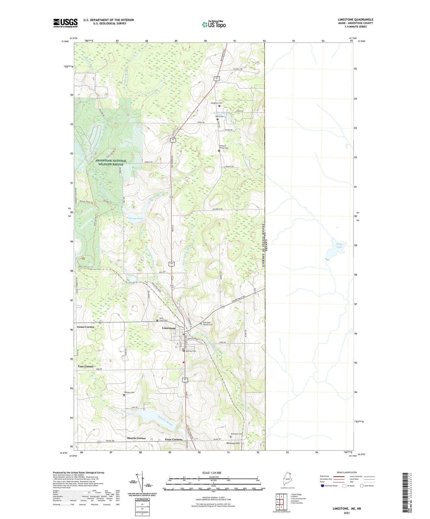
2024 topographic map quadrangle Limestone in the state of Maine. Scale: 1:24000. Based on the newly updated USGS 7.5' US Topo map series, this map is in the following counties: Aroostook. The map contains contour data, water features, and other items you are used to seeing on USGS maps, but also has updated roads and other features. This is the next generation of topographic maps. Printed on high-quality waterproof paper with UV fade-resistant inks.
Quads adjacent to this one:
West: Fort Fairfield NW
Northwest: Doyle Ridge
North: Hamlin
South: Fort Fairfield
Southwest: Goodwin
This map covers the same area as the classic USGS quad with code o46067h7.
Contains the following named places: Aroostook Mental Health Center, Aroostook National Wildlife Refuge, Butterfield Brook, Butterfield Brook Dam, Butterfield Brook Pond, California Road, Caswell Air Force Station, Caswell Plantation, Church of the Advent, Cote Corner, Daggett Brook, Dawn F Barnes Elementary School, Durepo Brook, Durepo Brook Dam, Durepo Pond, Episcopal Advent Cemetery, Four Corners, Grass Corner, Houghton Cemetery, Howland Family Cemetery, Kearney Cemetery, Kenneson Cemetery, Kennison Hill, Layton Lake, Limestone, Limestone Census Designated Place, Limestone Community Dam, Limestone Community School, Limestone Fire and Rescue, Limestone Police Department, Limestone Pond, Limestone Post Office, Maine School of Science and Mathematics, Morris Corner, Noyes Brook Dam, Noyes Pond, Peers Cemetery, Pierce Lake, Robert A Frost Memorial Library, Saint Louis Cemetery, Silver Spring Brook, Town of Limestone, Webster Brook Dam, Webster Cemetery, Willard Brook, ZIP Code: 04750