MyTopo
Gilead Maine US Topo Map
Couldn't load pickup availability
Also explore the Gilead Forest Service Topo of this same quad for updated USFS data
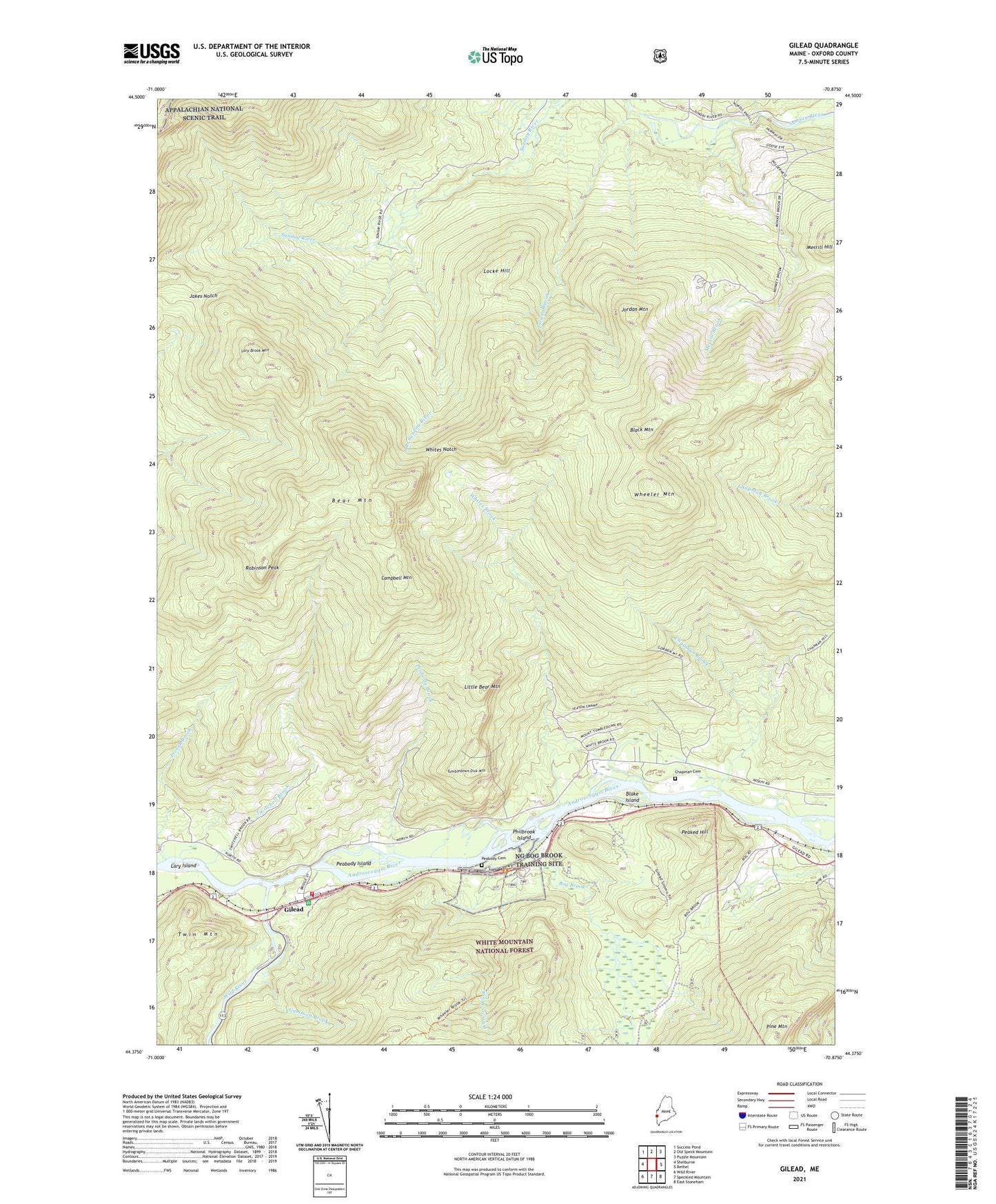
2024 topographic map quadrangle Gilead in the state of Maine. Scale: 1:24000. Based on the newly updated USGS 7.5' US Topo map series, this map is in the following counties: Oxford. The map contains contour data, water features, and other items you are used to seeing on USGS maps, but also has updated roads and other features. This is the next generation of topographic maps. Printed on high-quality waterproof paper with UV fade-resistant inks.
Quads adjacent to this one:
West: Shelburne
Northwest: Success Pond
North: Old Speck Mountain
Northeast: Puzzle Mountain
East: Bethel
Southeast: East Stoneham
South: Speckled Mountain
Southwest: Wild River
This map covers the same area as the classic USGS quad with code o44070d8.
Contains the following named places: Bear Mountain, Black Mountain, Blake Island, Bog Brook, Bull Branch, Campbell Mountain, Chapman Brook, Chapman Cemetery, Chapman School, Eames Brook, French Brook, Gammon Brook, Gilead, Gilead Fire Station, Jakes Notch, Jordan Brook, Jordan Mountain, Lary Brook Mountain, Lary Island, Little Bear Mountain, Locke Hill, Merrill Brook, Merrill Hill, Peabody Brook, Peabody Cemetery, Peabody Island, Peabody School, Peaked Hill, Philbrook Island, Pine Mountain, Pleasant River, Robinson Peak, South Branch Sunday River, Town of Gilead, Tumbledown Dick Mountain, Twin Mountain, Twitchell Brook, Wheeler Brook, Wheeler Mountain, Whites Brook, Whites Notch, Wild River