MyTopo
Old Speck Mountain Maine US Topo Map
Couldn't load pickup availability
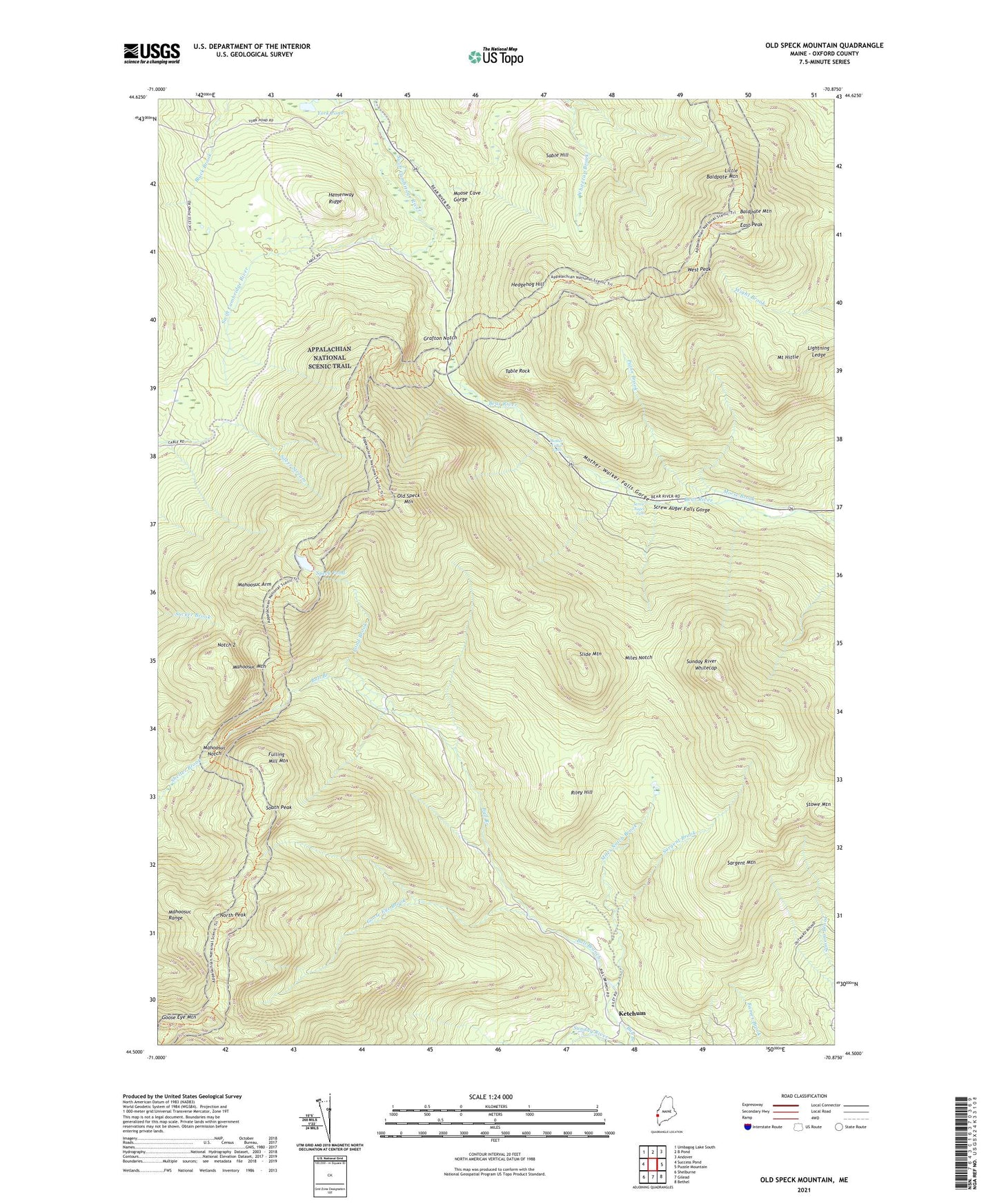
2024 topographic map quadrangle Old Speck Mountain in the state of Maine. Scale: 1:24000. Based on the newly updated USGS 7.5' US Topo map series, this map is in the following counties: Oxford. The map contains contour data, water features, and other items you are used to seeing on USGS maps, but also has updated roads and other features. This is the next generation of topographic maps. Printed on high-quality waterproof paper with UV fade-resistant inks.
Quads adjacent to this one:
West: Success Pond
Northwest: Umbagog Lake South
North: B Pond
Northeast: Andover
East: Puzzle Mountain
Southeast: Bethel
South: Gilead
Southwest: Shelburne
This map covers the same area as the classic USGS quad with code o44070e8.
Contains the following named places: Baldpate Mountain, Camp 3, East Peak, Fulling Mill Mountain, Goose Eye Brook, Goose Eye Mountain, Grafton Notch, Grafton Township, Hedgehog Hill, Hemenway Ridge, Ketchum, Ketchum Post Office, Little Baldpate Mountain, Mahoosuc Arm, Mahoosuc Mountain, Mahoosuc Notch, Mahoosuc Range, Miles Notch, Miles Notch Brook, Moose Cave Gorge, Morse Brook, Mother Walker Falls, Mother Walker Falls Gorge, Mount Hittie, North Peak, Notch 2, Old Speck Mountain, Old Speck Mountain Trail, Paine Brook, Pond Brook, Riley Hill, Sable Hill, Sargent Brook, Sargent Mountain, Screw Auger Falls, Screw Auger Falls Gorge, Slide Mountain, South Peak, Speck Pond, Spruce Meadow Picnic Area, Stowe Mountain, Sunday River Whitecap, Table Rock, Table Rock Trail, West Peak, York Pond, ZIP Code: 04261